Bear Canyon Trailhead (#46), Greenlee
Trailheads in Arizona
What to Pack for Bear Canyon Trailhead (#46), Greenlee
Pack with the terrain and wildlife in mind, and you'll be ready for anything here.
Don't underpack for Bear Canyon Trailhead (#46). The conditions here — Desert, Semi-Arid — call for thoughtful gear choices.
Essential
-
Water (minimum 2L) — Even cool-weather hiking demands steady hydration, as exertion and altitude increase water loss faster than most expect.
-
Navigation (map/GPS/compass) — Even well-marked trails have confusing junctions, especially in fog or snow; a GPS unit or downloaded map keeps you on route.
-
Sun protection (sunglasses, sunscreen) — Quality sunglasses prevent snow blindness and reduce eye strain during long days on exposed trails or ridgelines.
-
First aid kit — Adhesive bandages, antiseptic, and athletic tape handle the most common trail injuries and weigh under a pound.
-
Extra food — Blood sugar drops fast during sustained effort outdoors, and having a reserve keeps your body and mind sharp.
-
Headlamp with extra batteries — Batteries drain faster in cold weather; carrying spares ensures you won't be left in the dark when you need light most.
-
Fire starter — Starting a fire boosts morale and provides light, warmth, and a way to purify water in an emergency.
-
Emergency shelter (space blanket) — If an injury forces you to stop moving, a reflective blanket prevents the rapid heat loss that leads to hypothermia.
-
Knife or multi-tool — In a survival situation, a blade lets you process tinder, build shelter, and prepare food.
-
Extra clothing layer — Wet clothing accelerates cooling; a dry backup layer can prevent hypothermia when conditions turn.
Wildlife Gear
-
Hiking buddy (avoid solo) — Solo hikers are more vulnerable to predatory behavior from mountain lions, which typically avoid groups.
-
Noise maker — A loud whistle doubles as a rescue signal, serving both wildlife safety and emergency communication.
-
Gaiters — Beyond snakes, gaiters also protect against thorns, brush, and ticks in overgrown trail sections.
-
First-aid snakebite kit — A lightweight pressure bandage and marker for tracking swelling take up minimal space but provide critical aid.
Terrain Gear
-
Wide-brim hat — Desert and alpine environments with little tree cover leave you fully exposed; a hat is your primary shade source.
-
Sunscreen SPF50+ — Apply 30 minutes before exposure and reapply every 2 hours; sweating and pack straps rub sunscreen off faster than expected.
-
Extra water (desert) — Even well-mapped springs can go dry after low-snowpack years; always carry surplus and check recent trip reports.
Seasonal Gear
- Spring: Camera, Wildflower field guide
- Fall: Camera, Binoculars (foliage viewing)
Activities & Best Time to Visit Bear Canyon Trailhead (#46), Greenlee
The Desert terrain here lends itself to a range of outdoor activities throughout the year.
Activity options at Bear Canyon Trailhead (#46) range from casual () to more demanding ().
The scenery here earns a 65/100 photography rating — Exceptional dark sky (Bortle 1-2) and 3 excellent meteor showers.
Activities
-
hiking — With sturdy footwear and preparation, trails open up expansive views and quiet solitude.
-
photography — Outdoor photography invites you to slow down and frame the beauty around you.
-
picnicking — Whether lakeside or in a meadow, it's a relaxed way to savor both the setting and the company.
-
running — From flat paths to rolling hills, running outdoors adds variety to your routine.
-
walking — Perfect for all ages, a casual walk can turn any outdoor space into a relaxing nature experience.
-
wildlife_viewing — Bring binoculars and patience — nature often rewards careful, respectful observers.
Best months: May, Jun, Jul, Aug, Sep
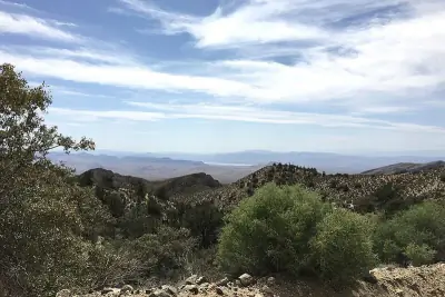
Terrain: Desert — Rocky outcrops, sand, and dry washes are common features.
Wildlife Safety at Bear Canyon Trailhead (#46), Greenlee
Before heading out, it helps to know which wildlife to be cautious around.
Responsible visitors at Bear Canyon Trailhead (#46) should be aware of 1 wildlife-related considerations.
- Mountain lions
- Venomous snakes
- Remote (150mi from city)
- Exceptional dark sky (Bortle 1-2)
- 3 excellent meteor showers
- Fall foliage
- Spring wildflowers
Venomous Snakes
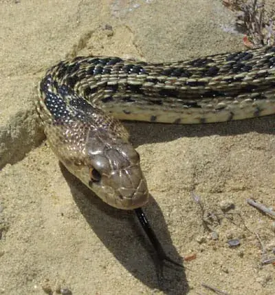
4 venomous snake species are found in this area: Western Diamondback, Mojave, Sidewinder, Arizona Coral Snake.
Broad triangular head, vertical pupils, and a stout body often exceeding 3 to 4 feet in length.
Remove constrictive items and remain calm; do not cut, suck, or apply ice to the wound.
Distinct facial stripe behind the eye and a prominent rattle.
Keep the victim calm and monitor breathing while awaiting medical care.
Usually under 2 feet long with a relatively short rattle.
Do not attempt to capture the snake; focus on reaching emergency care quickly.
Head is blunt with a black snout.
Keep the victim calm and still while awaiting treatment.
- Watch where you step and place hands
- Stay on trails
- Wear boots and long pants in snake country
- Do not reach under rocks or logs
- If bitten: stay calm, immobilize limb, seek medical help immediately
- Do NOT: cut wound, suck venom, apply tourniquet, ice, or alcohol
Nature & Wildlife at Bear Canyon Trailhead (#46), Greenlee
The Desert terrain here supports a rich ecosystem worth noticing as you explore.
From towering Southwestern Ponderosa Pine and Emory oak to delicate California poppy, the vegetation here creates habitat for 3 mammal species and 30 birds.
Trees (4)
-
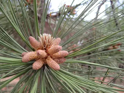 Southwestern Ponderosa Pine — Southwestern Ponderosa Pine is a large, long-needled conifer adapted to dry, high-elevation forests.
 -
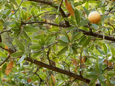 Emory oak — Emory oak is an evergreen oak with thick elongated leaves.
 -
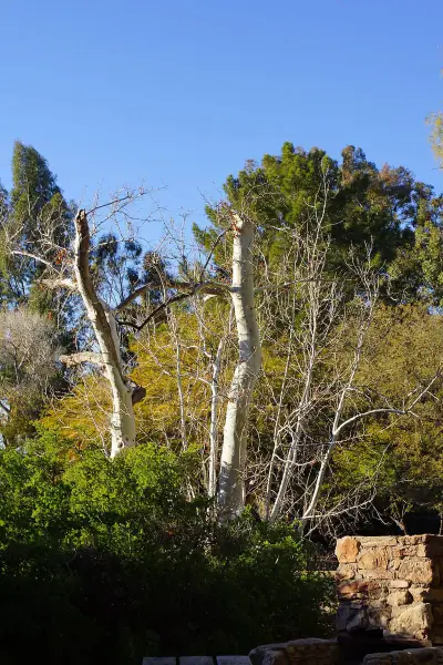 Arizona sycamore — Arizona sycamore is a riparian tree with mottled white and tan exfoliating bark.
 -
 gray oak — Gray oak is a small deciduous oak with narrow lobed leaves.
Wildflowers (1)
-
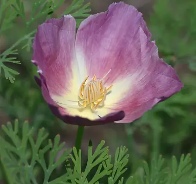 California poppy — Four-petaled blooms that close at night or in cool weather.
Shrubs (2)
-
 Creosote Bush — Bright yellow flowers bloom after rain.
 -
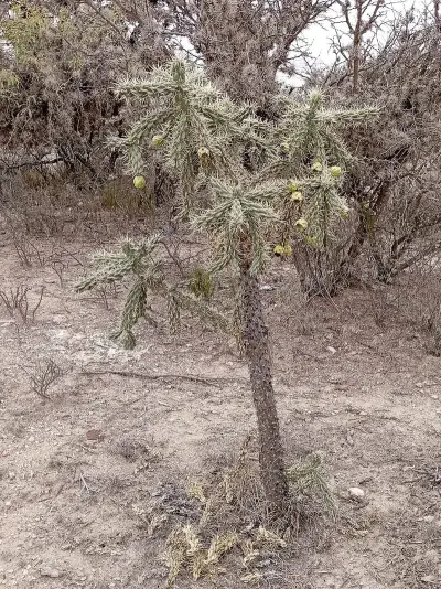 tree cholla — Tree cholla is an upright cactus with cylindrical segmented stems covered in barbed spines. It can reach 8 to 15 feet tall.
Other Plants (5)
-
alligator juniper
-
Parry's agave
-
ocotillo
-
pointleaf manzanita
-
fishhook barrel cactus
Mammals (3)
-
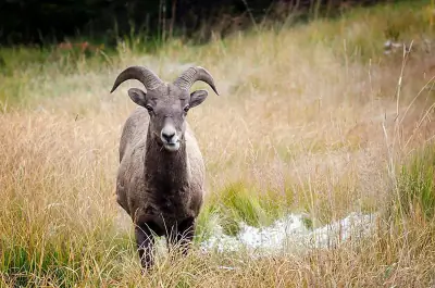 Bighorn Sheep — Sure-footed build adapted to steep cliffs.
 -
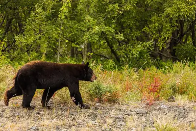 American Black Bear — Adults typically weigh 150–600 pounds depending on region and sex.
 -
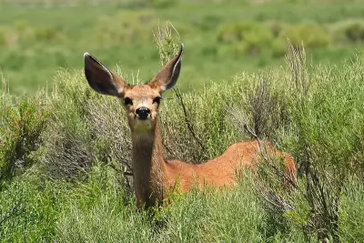 Mule Deer — Bucks carry branching antlers that fork rather than form a single main beam.
Birds (30)
-
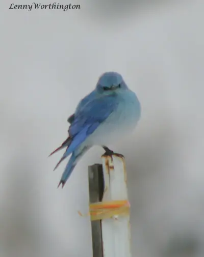 Mountain Bluebird — Slim thrush shape
 -
 Bufflehead — Compact body and short bill
 -
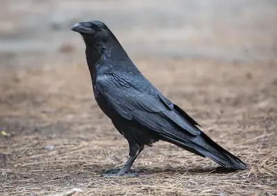 Common Raven — Heavy bill and wedge-shaped tail
 -
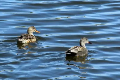 Gadwall — White wing patch visible in flight
 -
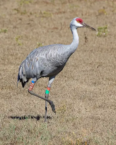 Sandhill Crane — Long legs and neck
Reptiles (5)
-
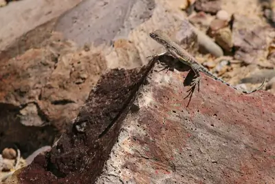 Greater Earless Lizard — Typically 4–6 inches long including tail.
 -
 Western Black-tailed Rattlesnake — Usually 2.5–4 feet long.
 -
 Ornate Tree Lizard — Typically 4–6 inches long.
 -
 Gopher Snake — Adults commonly reach 3–6 feet in length.
 -
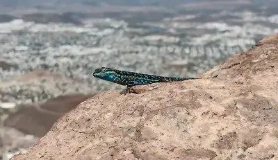
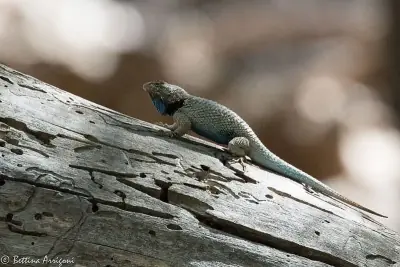 Clark's Spiny Lizard — Usually 5–8 inches long.
Amphibians (2)
-
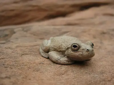 Canyon Tree Frog
 -
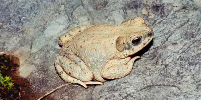 Red-spotted Toad
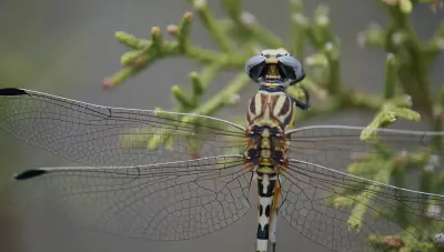
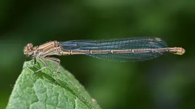
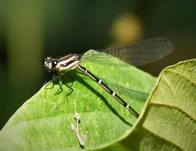
Insects (14)
-
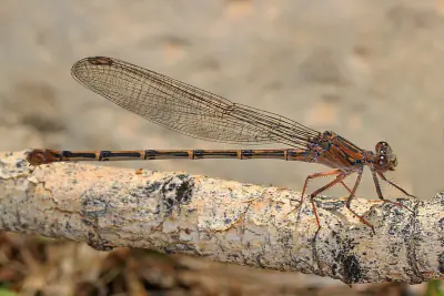
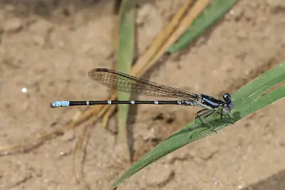 Blue-ringed Dancer
 -
 White-belted Ringtail
 -
 Powdered Dancer
 -
 Dusky Dancer
 -
 Sooty Dancer
Other Wildlife (2)
-
Arizona Bark Scorpion
-
Red Shiner
Nature Bingo at Bear Canyon Trailhead (#46), Greenlee
Can you spot them all? Check off each species as you find it on your visit.
Wildlife Challenge
Botany Challenge
Bear Canyon Trailhead (#46), Greenlee Climate & Sun
The numbers behind the best (and worst) times to visit Bear Canyon Trailhead (#46).
Reference climate data for planning your visit to Bear Canyon Trailhead (#46) — temperatures, precipitation, and daylight hours.
Climate type: Semi-Arid
Annual avg temp: 56.9°F
Annual precipitation: 16.1 in
With an average annual temperature of 56.9°F and 16.1 inches of precipitation, Bear Canyon Trailhead (#46) has mild, dry conditions. Summer highs average around 76°F, while winter lows drop to 40°F.
Best months to visit: Apr, May, Jun, Sep, Oct.
| Month | Avg Temp | Precip |
|---|---|---|
| Jan | 40°F | 1.5 in |
| Feb | 43°F | 1.3 in |
| Mar | 48°F | 1.0 in |
| Apr | 54°F | 0.4 in |
| May | 62°F | 0.4 in |
| Jun | 72°F | 0.4 in |
| Jul | 76°F | 2.8 in |
| Aug | 74°F | 3.0 in |
| Sep | 69°F | 1.9 in |
| Oct | 58°F | 1.0 in |
| Nov | 48°F | 1.0 in |
| Dec | 40°F | 1.4 in |
Daylight & Sun Times
Daylight ranges from 10 hours in winter to 14.3 hours in summer — a difference of 4.3 hours.
Summer: 5:07 AM – 7:28 PM
Winter: 7:14 AM – 5:11 PM
Bear Canyon Trailhead (#46), Greenlee Trip Planning & Access
Time to plan the details — access, cost, and travel information for your visit.
Here are the logistics for getting to Bear Canyon Trailhead (#46) and what to expect on arrival.
Visitor Friendliness
Accessibility: dog-friendly (likely_allowed), family-friendly (moderate), elderly-friendly (challenging).
- Dogs: likely_allowed — No restrictions found
- Families: moderate (Long distance (>5mi), Steep climb (>1000ft))
- Elderly: challenging (Long distance (>2mi), Significant elevation (>200ft), Unpaved surface)
- Strollers: not_recommended (20/100)
- Beginners: Good starting point (Moderate difficulty (+5))
- Accessibility: Generally accessible to most visitors (90/100)
Places Near Bear Canyon Trailhead (#46), Greenlee
Looking for more? Here's what else is close by.
Close-by alternatives and additions to your Bear Canyon Trailhead (#46) visit include these 15 destinations.
Nearby Trails
- Cottonwood Trail, Greenlee 4.87 mi
- Pipestem Trail, Greenlee 7.54 mi
- Mud Springs Trail, Greenlee 7.56 mi
- Coyote Trail, Greenlee 9.38 mi
Nearby Campgrounds
- Honeymoon Campground (N, 0mi), Greenlee 8.32 mi
- Upper Juan Miller Cg Campground, Greenlee 9.88 mi
- Lower Juan Miller Cg Campground, Greenlee 10.26 mi
- Granville Cg Campground, Greenlee 13.02 mi
- Kp Cienega Cg Campground, Greenlee 16.99 mi
Stargazing & Night Sky at Bear Canyon Trailhead (#46), Greenlee
Clear nights in this area reveal more stars than most people expect.
The darkness at Bear Canyon Trailhead (#46) is rated Bortle class 2, offering Typical truly dark site conditions year-round.
Constellations
Key constellations visible from this latitude include Ursa Minor, Cepheus.
-
 Ursa Minor — Visible throughout the year in much of the United States, Ursa Minor rotates steadily around the North Celestial Pole.
 -
 Cepheus — Though its stars are modest in brightness, Cepheus is visible year-round from most of the U.S.
Meteor Showers
The Geminids peaks around December 13-14 and is the best meteor shower visible from here.
-
 Geminids — peaks December 13-14 (excellent)
Find a dark location away from city lights and give your eyes 20–30 minutes to adjust for peak rates.
-
 Quadrantids — peaks January 3-4 (excellent)
Look toward the northern sky after midnight for the highest activity.
-
 Perseids — peaks August 11-13 (excellent)
Expect fast, bright meteors and occasional fireballs under dark skies.
-
 Eta Aquariids — peaks May 5-6 (good)
Plan for early morning viewing; activity increases in the hours just before sunrise.
-
 Delta Aquariids — peaks July 28-29 (fair)
Southern states often see stronger activity due to radiant placement.
Planets
Planets visible to the naked eye from this location:
-
 Venus — The brightest planet, often called the Morning or Evening Star
 -
 Jupiter — The largest planet, bright and steady in the night sky
 -
 Saturn — Famous for its rings, visible as a golden steady light
 -
 Mars — The Red Planet, recognizable by its reddish-orange hue
Equipment Guide
- Naked eye: Venus, Jupiter, Saturn, Mars, Mercury (with care)
- Binoculars: Jupiter moons, Uranus, Saturn rings (barely)
- Small telescope: Saturn rings, Jupiter bands, Mars surface features, Neptune
Viewing Tips
- Check planets rise/set times for your specific date
- Planets appear along the ecliptic (zodiac path)
- Planets don't twinkle like stars - steady light
- Venus and Jupiter are unmistakable - brightest objects after Moon
- Use a stargazing app to confirm planet positions
- Best viewing: when planet is highest in sky (transit)
Best Viewing Months
- Evening: Oct, Nov, Dec, Jan, Feb
- Morning: Jul, Aug, Sep
Seasonal Highlights at Bear Canyon Trailhead (#46), Greenlee
What you'll encounter here shifts with the calendar — here's a seasonal overview.
The experience at Bear Canyon Trailhead (#46) shifts with the seasons. Here's a month-by-month overview.
Spring Wildflowers
Peak bloom: March - April
Check local park websites for bloom reports
Fall Foliage
Peak color: October 15 – November 5
Best trees for color: Maple, Oak, Aspen
Higher elevations peak 1-2 weeks earlier
Bird Migration
Spring peak: March - April
Fall peak: October - November
Best spots: Wetlands, coastlines, mountain ridges
Indigenous Land at Bear Canyon Trailhead (#46), Greenlee
The history of this land reaches back long before it became a recreation destination.
Before trails were marked here, Pueblos, Ndee/Nnēē: (Western Apache) knew this land intimately.
Territories
Data from Native Land Digital
Bear Canyon Trailhead (#46), Greenlee Geology & Natural History
Beyond the trails and wildlife, Bear Canyon Trailhead (#46) sits within a landscape shaped by millions of years of geological processes. Here's what researchers and surveys have documented about this area.
Bedrock Geology
- Rock Type
- Middle Miocene to Oligocene volcanic rocks
- Formation
- Peach Springs Tuff; Apache Leap Tuff
- Lithology
- Major:{basalt,andesite,dacite}, Minor:{rhyolite}
- Age
- Cenozoic
Mineral Deposits
- Deposit Sites
- 14
- Richness
- Moderate
- Minerals Found
- Copper, Gold, Silver, Lead, Iron, Silica, Manganese, Zinc
Endangered Species
- Species at Risk
- 1478
- ESA Endangered
- 29
- ESA Threatened
- 16
- Conservation Score
- 100/100
Wildfire History
This area has a relatively low wildfire risk, but always follow posted fire regulations.
- Recorded Fires
- 30
- Largest Fire
- Red Point Tank (5,154.8 acres)
- Most Recent
- 2024
- Fire Risk
- Extreme
Watershed
- Watershed
- Park Creek
- Water Quality (Good)
- 0%
- Impaired
- 0%
Bear Canyon Trailhead (#46), Greenlee Safety & Conditions
Plans set? Check the latest conditions before you head out.
Before any visit to Bear Canyon Trailhead (#46), a quick check of these official sources can prevent surprises.
Coordinates: 33.354908, -109.484147