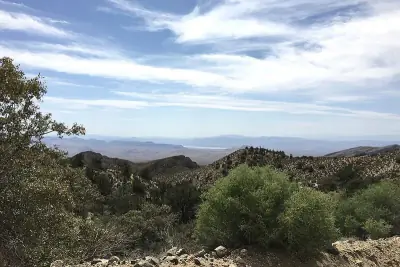
Flying W Group Day Use Area, Graham
Day Use Areas in Arizona
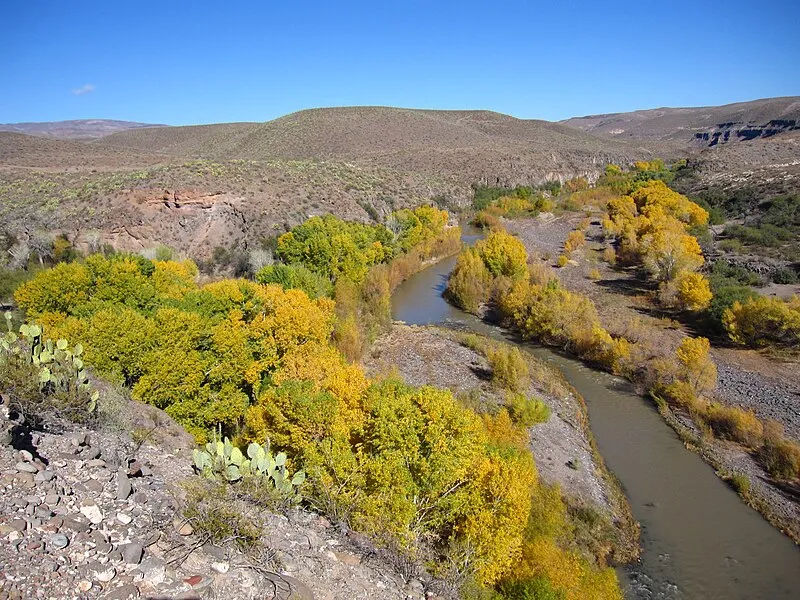
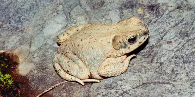
Photo: Chris M Morris / CC BY 2.0
Near Safford, AZ in Arizona
What to Pack for Flying W Group Day Use Area, Graham
Being properly equipped turns potential hazards into manageable situations.
Pack for Desert terrain, Arid, and the wildlife considerations above.
Essential
-
Water (minimum 2L) — Dehydration impairs judgment and endurance long before you feel thirsty; 2L is the minimum for a moderate day hike.
-
Navigation (map/GPS/compass) — Phone batteries die, cell service disappears, and trail signs get vandalized; a paper map and compass always work.
-
Sun protection (sunglasses, sunscreen) — UV exposure intensifies at elevation and near reflective surfaces like water and snow; sunburn can happen in under 30 minutes.
-
First aid kit — Blisters, cuts, and sprains happen on even the easiest trails; basic supplies let you treat problems before they force a retreat.
-
Extra food — A wrong turn or unexpected storm can extend any outing by hours; extra calories prevent fatigue and poor decision-making.
-
Headlamp with extra batteries — Trails that seem short in daylight can take twice as long with route-finding or elevation; a headlamp keeps you moving safely after dark.
-
Fire starter — Hypothermia can set in even during summer at higher elevations; a reliable fire starter provides warmth and a signal for rescuers.
-
Emergency shelter (space blanket) — A space blanket weighs under two ounces and reflects up to 90% of body heat, buying time in an unplanned overnight.
-
Knife or multi-tool — From cutting cord to preparing food to improvising gear repairs, a knife is the most versatile tool you can carry.
-
Extra clothing layer — Mountain weather can shift from sunshine to sleet within an hour; an extra layer prevents dangerous heat loss.
Wildlife Gear
-
Hiking buddy (avoid solo) — Groups of three or more are almost never involved in serious bear incidents; larger groups make more noise and appear more intimidating.
-
Noise maker — Clapping, whistling, or using an air horn warns wildlife of your approach, preventing surprise encounters on blind corners.
-
Gaiters — Snake-proof gaiters provide a physical barrier against venomous bites below the knee, where most strikes occur.
-
First-aid snakebite kit — While evacuation to a hospital is the priority, a snakebite kit helps you stay calm and follow proper first-aid protocols.
Terrain Gear
-
Wide-brim hat — A wide brim shades your face, ears, and neck simultaneously, reducing UV exposure and lowering heat stroke risk.
-
Sunscreen SPF50+ — Reflected UV from water, sand, and snow can burn exposed skin even on overcast days; SPF50+ blocks 98% of UVB rays.
-
Extra water (desert) — Desert water sources are unreliable and often seasonal; carry all the water you need rather than counting on finding more.
Seasonal Gear
- Spring: Camera, Wildflower field guide
- Fall: Camera, Binoculars (foliage viewing)
Activities & Best Time to Visit Flying W Group Day Use Area, Graham
The Desert terrain here lends itself to a range of outdoor activities throughout the year.
Whether you're here for photography or looking to try something different, Flying W Group Day Use Area has options.
Photographers rate this area 65/100, with Exceptional dark sky (Bortle 1-2) and 3 excellent meteor showers being a major draw.
Activities
-
photography — Capture landscapes, wildlife, and changing light across trails, coastlines, and mountain vistas.
-
picnicking — Spread a blanket, unpack a meal, and enjoy food outdoors surrounded by fresh air and open views.
-
rv_camping — Travel with the comforts of home while staying in campgrounds or RV parks.
-
walking — A simple way to explore trails, shorelines, and park paths at your own pace while taking in the scenery.
-
wildlife_viewing — Observe animals in their natural habitats, from grazing deer to soaring raptors overhead.
Best months: Oct, Nov, Dec, Jan, Feb, Mar, Apr
Terrain: Desert — Desert terrain features sparse vegetation, exposed soils, and wide temperature swings between day and night.
Wildlife Safety at Flying W Group Day Use Area, Graham
Part of visiting responsibly is understanding the wildlife safety considerations for this area.
Most visitors at Flying W Group Day Use Area never have a wildlife incident, but a danger score of 30/10 means preparation matters.
- Mountain lions
- Venomous snakes
- Remote (155mi from city)
- Exceptional dark sky (Bortle 1-2)
- 3 excellent meteor showers
- Fall foliage
- Spring wildflowers
Venomous Snakes
Venomous snakes here include . They're most active during warm months.
- Watch where you step and place hands
- Stay on trails
- Wear boots and long pants in snake country
- Do not reach under rocks or logs
- If bitten: stay calm, immobilize limb, seek medical help immediately
- Do NOT: cut wound, suck venom, apply tourniquet, ice, or alcohol
Nature & Wildlife at Flying W Group Day Use Area, Graham
The Desert terrain here supports a rich ecosystem worth noticing as you explore.
The Desert environment here supports 38 documented species across mammals, birds, reptiles, and amphibians.
Trees (4)
-
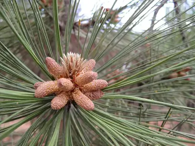 Southwestern Ponderosa Pine — The tree is highly fire-adapted and thrives with periodic low-intensity burns.
 -
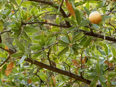 Emory oak — It grows in desert mountains of the Southwest.
 -
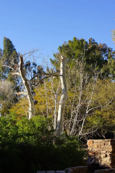 Arizona sycamore — It grows along streams in desert and canyon environments.
 -
 gray oak — It grows in dry foothill habitats.
Wildflowers (1)
-
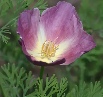 California poppy — Bright orange cup-shaped flowers with silky petals.
Shrubs (2)
-
 Creosote Bush — Bright yellow flowers bloom after rain.
 -
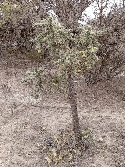 tree cholla — Spiny segments create a dense protective armor. It thrives in desert flats and rocky slopes.
Other Plants (5)
-
alligator juniper
-
Parry's agave
-
ocotillo
-
pointleaf manzanita
-
fishhook barrel cactus
Mammals (3)
-
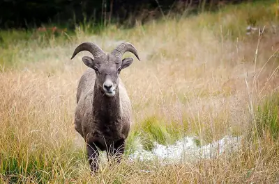 Bighorn Sheep — Stocky mountain sheep with tan coat and white rump.
 -
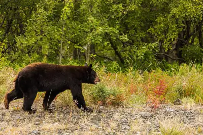 American Black Bear — A stocky bear with rounded ears and a straight facial profile.
 -
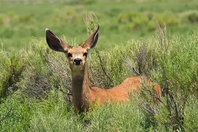 Mule Deer — A large deer with oversized mule-like ears and a black-tipped tail.
Birds (30)
-
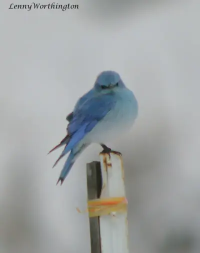 Mountain Bluebird — Bright sky-blue male
 -
 Bufflehead — Small duck with large white head patch
 -
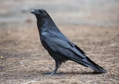 Common Raven — Large all-black bird with shaggy throat
 -
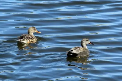 Gadwall — Subtle gray male with black rump
 -
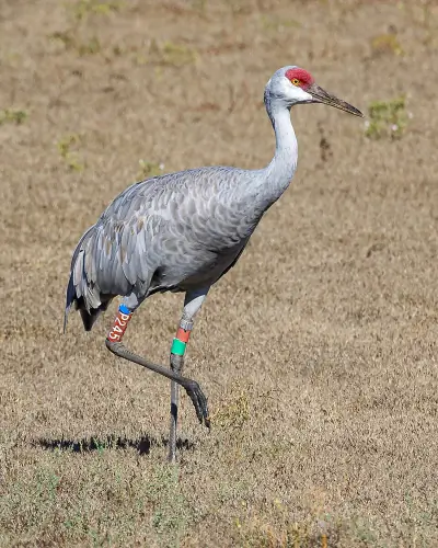 Sandhill Crane — Tall gray body
Reptiles (5)
-
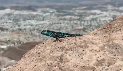
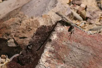 Greater Earless Lizard — A small lizard lacking visible external ear openings.
 -
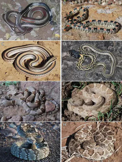 Western Black-tailed Rattlesnake — A stout rattlesnake with olive or yellowish body and dark tail.
 -
 Ornate Tree Lizard — A small spiny lizard with gray to brown coloration and subtle patterning.
 -
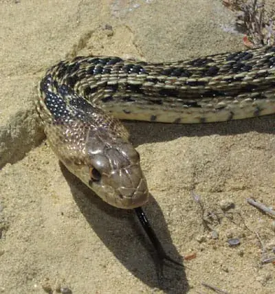 Gopher Snake — A large tan or yellowish snake with dark brown blotches along the back.
 -
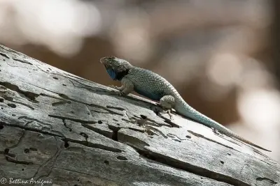 Clark's Spiny Lizard — A medium lizard with rough scales and gray to brown coloration.
Amphibians (2)
-
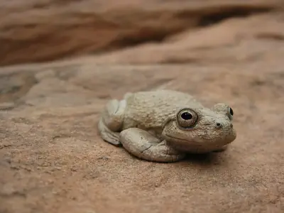 Canyon Tree Frog
 -
 Red-spotted Toad
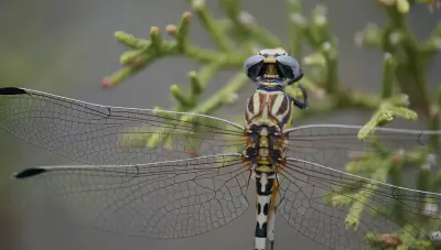
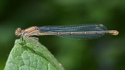
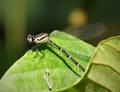
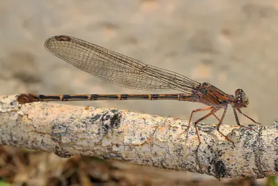
Insects (14)
-
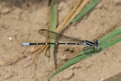 Blue-ringed Dancer
 -
 White-belted Ringtail
 -
 Powdered Dancer
 -
 Dusky Dancer
 -
 Sooty Dancer
Other Wildlife (2)
-
Arizona Bark Scorpion
-
Red Shiner
Nature Bingo at Flying W Group Day Use Area, Graham
Can you spot them all? Check off each species as you find it on your visit.
Wildlife Challenge
Botany Challenge
Flying W Group Day Use Area, Graham Climate & Sun
Reference data: temperatures, precipitation, and daylight hours by month.
The annual average temperature here is 64.4°F, with 9.3 inches of precipitation.
Climate type: Arid
Annual avg temp: 64.4°F
Annual precipitation: 9.3 in
With an average annual temperature of 64.4°F and 9.3 inches of precipitation, Flying W Group Day Use Area has warm, arid conditions. Summer highs average around 84°F, while winter lows drop to 46°F.
Best months to visit: Mar, Apr, May, Oct, Nov.
| Month | Avg Temp | Precip |
|---|---|---|
| Jan | 46°F | 0.9 in |
| Feb | 50°F | 0.8 in |
| Mar | 56°F | 0.5 in |
| Apr | 63°F | 0.3 in |
| May | 71°F | 0.2 in |
| Jun | 81°F | 0.3 in |
| Jul | 84°F | 1.6 in |
| Aug | 82°F | 1.5 in |
| Sep | 77°F | 1.0 in |
| Oct | 66°F | 0.7 in |
| Nov | 54°F | 0.6 in |
| Dec | 45°F | 0.9 in |
Daylight & Sun Times
Daylight ranges from 10 hours in winter to 14.3 hours in summer — a difference of 4.3 hours.
Summer: 5:08 AM – 7:27 PM
Winter: 7:12 AM – 5:13 PM
Flying W Group Day Use Area, Graham Trip Planning & Access
Here's the practical side of visiting Flying W Group Day Use Area.
Flying W Group Day Use Area is 155 miles from Phoenix — here's what to budget for the trip.
Visitor Friendliness
This location rates likely_allowed for dogs, excellent for families, and highly_suitable for elderly visitors.
- Dogs: likely_allowed — No restrictions found
- Families: excellent
- Elderly: highly_suitable
- Strollers: excellent (100/100)
- Beginners: Perfect for beginners (Easy difficulty - perfect for beginners (+20))
- Accessibility: Generally accessible to most visitors (100/100)
Places Near Flying W Group Day Use Area, Graham
The area around Flying W Group Day Use Area has plenty more to offer.
If you're exploring this part of Arizona, these nearby spots complement a visit to Flying W Group Day Use Area.
Nearby Trails
- Pleasant Valley Trail, Greenlee 17.33 mi
- Hickey Springs Trail, Greenlee 17.86 mi
- Crystal Cave Trail, Greenlee 20.72 mi
- Painted Bluff Trail, Greenlee 20.87 mi
- Pinal Trail, Greenlee 21.93 mi
Nearby Campgrounds
- Riverview Campground, Graham 0.26 mi
- Owl Creek Campground, Greenlee 11.64 mi
- Granville Cg Campground, Greenlee 21.71 mi
Stargazing & Night Sky at Flying W Group Day Use Area, Graham
After a day outdoors, the evening sky here is worth a look.
On clear nights, the Bortle class 2 skies above Flying W Group Day Use Area reveal constellations and bright planets.
Constellations
From Flying W Group Day Use Area, you can trace Ursa Minor, Cepheus across the sky on clear nights.
-
 Ursa Minor — Home to Polaris, the North Star, Ursa Minor forms a small dipper shape that circles the northern sky year-round.
 -
 Cepheus — Cepheus appears as a faint house-shaped pattern near Polaris in the northern sky.
Meteor Showers
Time your visit around December 13-14 for the Geminids, the strongest meteor shower visible from this latitude.
-
 Geminids — peaks December 13-14 (excellent)
One of the most reliable and active showers of the year; best viewed after 10 PM when Gemini rises higher in the sky.
-
 Quadrantids — peaks January 3-4 (excellent)
This brief but intense shower peaks before dawn; early morning hours offer the best chance to see multiple meteors.
-
 Perseids — peaks August 11-13 (excellent)
A summer favorite with warm nighttime viewing; look northeast after 10 PM.
-
 Eta Aquariids — peaks May 5-6 (good)
Best seen before dawn in the southeastern sky as Aquarius rises.
-
 Delta Aquariids — peaks July 28-29 (fair)
Best viewed after midnight when Aquarius is higher in the southern sky.
Planets
Planets visible to the naked eye from this location:
-
 Venus — The brightest planet, often called the Morning or Evening Star
 -
 Jupiter — The largest planet, bright and steady in the night sky
 -
 Saturn — Famous for its rings, visible as a golden steady light
 -
 Mars — The Red Planet, recognizable by its reddish-orange hue
Equipment Guide
- Naked eye: Venus, Jupiter, Saturn, Mars, Mercury (with care)
- Binoculars: Jupiter moons, Uranus, Saturn rings (barely)
- Small telescope: Saturn rings, Jupiter bands, Mars surface features, Neptune
Viewing Tips
- Check planets rise/set times for your specific date
- Planets appear along the ecliptic (zodiac path)
- Planets don't twinkle like stars - steady light
- Venus and Jupiter are unmistakable - brightest objects after Moon
- Use a stargazing app to confirm planet positions
- Best viewing: when planet is highest in sky (transit)
Best Viewing Months
- Evening: Oct, Nov, Dec, Jan, Feb
- Morning: Jul, Aug, Sep
Seasonal Highlights at Flying W Group Day Use Area, Graham
The time of year you visit changes what you'll see and do.
Timing your visit to Flying W Group Day Use Area around seasonal highlights can make a major difference in what you experience.
Spring Wildflowers
Peak bloom: March - April
Check local park websites for bloom reports
Fall Foliage
Peak color: October 25 – November 15
Best trees for color: Maple, Oak, Aspen
Higher elevations peak 1-2 weeks earlier
Bird Migration
Spring peak: March - April
Fall peak: October - November
Best spots: Wetlands, coastlines, mountain ridges
Indigenous Land at Flying W Group Day Use Area, Graham
Before planning your trip, it's worth recognizing the Indigenous peoples connected to this land.
Before this became a recreation area, this land belonged to Chiricahua Apache, Ndee/Nnēē: (Western Apache).
Territories
Languages
Indigenous languages connected to this territory include White Mountain, Chiricahua.
Data from Native Land Digital
Flying W Group Day Use Area, Graham Geology & Natural History
Beyond the trails and wildlife, Flying W Group Day Use Area sits within a landscape shaped by millions of years of geological processes. Here's what researchers and surveys have documented about this area.
Bedrock Geology
- Rock Type
- Early Pleistocene to latest Pliocene surficial deposits
- Lithology
- Major:{gravel,sand}
- Age
- Cenozoic
Fossils
- Fossil Occurrences
- 97
- Unique Species
- 61
- Oldest
- 137.1 million years ago
Mineral Deposits
- Deposit Sites
- 83
- Richness
- Exceptional
- Minerals Found
- Copper, Sand and Gravel, Construction, Uranium, Diatomite, Gold, Silver, Pumice
Endangered Species
- Species at Risk
- 1478
- ESA Endangered
- 29
- ESA Threatened
- 16
- Conservation Score
- 100/100
Temperature Records
- Record High
- 116°F (1971-06-29)
- Record Low
- 4°F (2011-02-03)
Wildfire History
This area has a high wildfire risk. Check current fire conditions before visiting and follow all fire restrictions. Campfires may be banned during dry seasons.
- Recorded Fires
- 15
- Largest Fire
- Veach (811.6 acres)
- Most Recent
- 2024
- Fire Risk
- High
Watershed
- Watershed
- Judia Canyon-San Simon River
- Water Quality (Good)
- 0%
- Impaired
- 0%
Reported Phenomena
- UFO Sightings
- 15 (NUFORC)
- Bigfoot Reports
- 1 (BFRO)
- Eeriness Score
- 38/100
Flying W Group Day Use Area, Graham Safety & Conditions
The weather data above tells you what's typical — these links tell you what's happening right now.
Before visiting Flying W Group Day Use Area, verify current conditions through these authoritative sources.
Coordinates: 32.884462, -109.482689