Mt. Dellenbaugh Trailhead (E, 0mi), Mohave
Trailheads in Arizona
Near Peach Springs, AZ in Arizona
What to Pack for Mt. Dellenbaugh Trailhead (E, 0mi), Mohave
Being properly equipped turns potential hazards into manageable situations.
Pack for Desert terrain, Semi-Arid, and the wildlife considerations above.
Essential
-
Water (minimum 2L) — Dehydration impairs judgment and endurance long before you feel thirsty; 2L is the minimum for a moderate day hike.
-
Navigation (map/GPS/compass) — Phone batteries die, cell service disappears, and trail signs get vandalized; a paper map and compass always work.
-
Sun protection (sunglasses, sunscreen) — UV exposure intensifies at elevation and near reflective surfaces like water and snow; sunburn can happen in under 30 minutes.
-
First aid kit — Blisters, cuts, and sprains happen on even the easiest trails; basic supplies let you treat problems before they force a retreat.
-
Extra food — A wrong turn or unexpected storm can extend any outing by hours; extra calories prevent fatigue and poor decision-making.
-
Headlamp with extra batteries — Trails that seem short in daylight can take twice as long with route-finding or elevation; a headlamp keeps you moving safely after dark.
-
Fire starter — Hypothermia can set in even during summer at higher elevations; a reliable fire starter provides warmth and a signal for rescuers.
-
Emergency shelter (space blanket) — A space blanket weighs under two ounces and reflects up to 90% of body heat, buying time in an unplanned overnight.
-
Knife or multi-tool — From cutting cord to preparing food to improvising gear repairs, a knife is the most versatile tool you can carry.
-
Extra clothing layer — Mountain weather can shift from sunshine to sleet within an hour; an extra layer prevents dangerous heat loss.
Wildlife Gear
-
Bear canister — Storing food in a bear canister prevents bears from associating humans with food, which is the leading cause of dangerous bear behavior.
-
Bear spray — Studies show bear spray stops aggressive bear behavior in over 90% of encounters, outperforming firearms in field effectiveness.
-
Bear bell — Most bear encounters happen when hikers surprise a bear at close range; a bell provides continuous noise that alerts bears to your presence.
-
Hiking buddy (avoid solo) — Groups of three or more are almost never involved in serious bear incidents; larger groups make more noise and appear more intimidating.
-
Noise maker — Clapping, whistling, or using an air horn warns wildlife of your approach, preventing surprise encounters on blind corners.
-
Gaiters — Snake-proof gaiters provide a physical barrier against venomous bites below the knee, where most strikes occur.
-
First-aid snakebite kit — While evacuation to a hospital is the priority, a snakebite kit helps you stay calm and follow proper first-aid protocols.
Terrain Gear
-
Wide-brim hat — A wide brim shades your face, ears, and neck simultaneously, reducing UV exposure and lowering heat stroke risk.
-
Sunscreen SPF50+ — Reflected UV from water, sand, and snow can burn exposed skin even on overcast days; SPF50+ blocks 98% of UVB rays.
-
Extra water (desert) — Desert water sources are unreliable and often seasonal; carry all the water you need rather than counting on finding more.
Seasonal Gear
- Spring: Camera, Wildflower field guide
- Fall: Camera, Binoculars (foliage viewing)
Activities & Best Time to Visit Mt. Dellenbaugh Trailhead (E, 0mi), Mohave
The Desert terrain here lends itself to a range of outdoor activities throughout the year.
Whether you're here for backpacking or looking to try something different, Mt. Dellenbaugh Trailhead has options.
Photographers rate this area 55/100, with Good dark sky (Bortle 3) and 3 excellent meteor showers being a major draw.
Activities
-
backpacking — Carry your gear into the backcountry for multi-day hiking adventures.
-
hiking — Follow marked trails through forests, deserts, or alpine terrain for a deeper connection with nature.
-
photography — Capture landscapes, wildlife, and changing light across trails, coastlines, and mountain vistas.
-
picnicking — Spread a blanket, unpack a meal, and enjoy food outdoors surrounded by fresh air and open views.
-
walking — A simple way to explore trails, shorelines, and park paths at your own pace while taking in the scenery.
-
wildlife_viewing — Observe animals in their natural habitats, from grazing deer to soaring raptors overhead.
Best months: Oct, Nov, Dec, Jan, Feb, Mar, Apr
Terrain: Desert — Desert terrain features sparse vegetation, exposed soils, and wide temperature swings between day and night.
Wildlife Safety at Mt. Dellenbaugh Trailhead (E, 0mi), Mohave
Part of visiting responsibly is understanding the wildlife safety considerations for this area.
Most visitors at Mt. Dellenbaugh Trailhead never have a wildlife incident, but a danger score of 40/10 means preparation matters.
- Bears present
- Mountain lions
- Venomous snakes
- Far from city (90mi)
- Good dark sky (Bortle 3)
- 3 excellent meteor showers
- Fall foliage
- Spring wildflowers
Bears
This is Black Bear country. Encounters are uncommon but possible, especially during .
A stocky bear with rounded ears, a straight facial profile, and short curved claws built for climbing.
If you encounter one, speak calmly, make yourself appear larger, and back away slowly without running.
- Store food properly - use bear boxes or hang food bags
- Keep a clean camp - no food scraps
- Make noise while hiking
- Never approach cubs - mother is nearby
- Back away slowly if you encounter a bear
Venomous Snakes
Venomous snakes here include . They're most active during warm months.
- Watch where you step and place hands
- Stay on trails
- Wear boots and long pants in snake country
- Do not reach under rocks or logs
- If bitten: stay calm, immobilize limb, seek medical help immediately
- Do NOT: cut wound, suck venom, apply tourniquet, ice, or alcohol
Nature & Wildlife at Mt. Dellenbaugh Trailhead (E, 0mi), Mohave
The Desert terrain here supports a rich ecosystem worth noticing as you explore.
The Desert environment here supports 11 documented species across mammals, birds, reptiles, and amphibians.
Wildflowers (1)
-
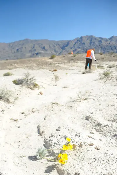 Las Vegas Bearpoppy — Large white crinkled petals with bright yellow centers.
Shrubs (4)
-
 Creosote Bush — Bright yellow flowers bloom after rain.
 -
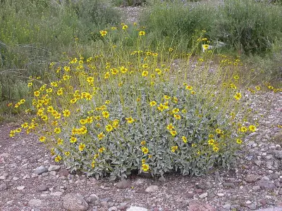 Brittlebush — Leaves are soft and pale gray, contrasting with long-stemmed golden blooms.
 -
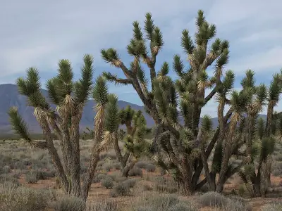 Eastern Joshua tree — Cream-colored flower clusters appear in spring.
Other Plants (5)
-
Buckhorn Cholla
-
Echinocereus bakeri
-
California Barrel Cactus
-
Beavertail Pricklypear
-
Mojave Yucca
Mammals (2)
-
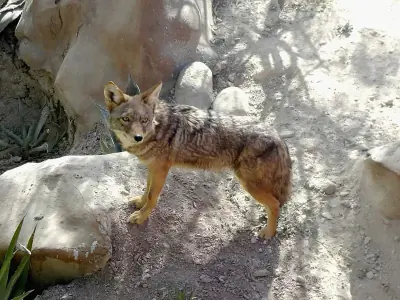 Coyote — A medium-sized canid with gray-brown fur and bushy tail tipped in black.
 -
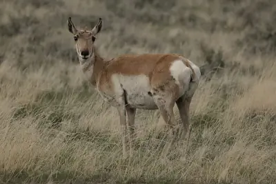 Pronghorn — A slender tan-and-white ungulate with distinctive black facial markings.
Birds (6)
-
 Great-tailed Grackle — Glossy black male with long tail
 -
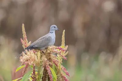 Eurasian Collared-Dove — Pale gray-beige body
 -
 American Kestrel — Rusty back
 -
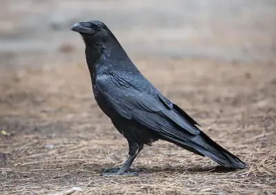 Common Raven — Large all-black bird with shaggy throat
 -
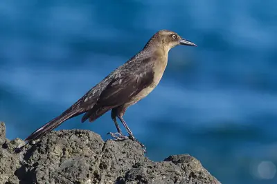
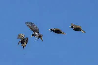 European Starling — Glossy black with iridescent green and purple sheen
Reptiles (3)
-
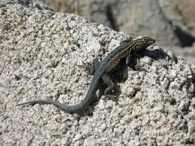 Common Side-blotched Lizard — A small slender lizard with mottled brown or gray coloration.
 -
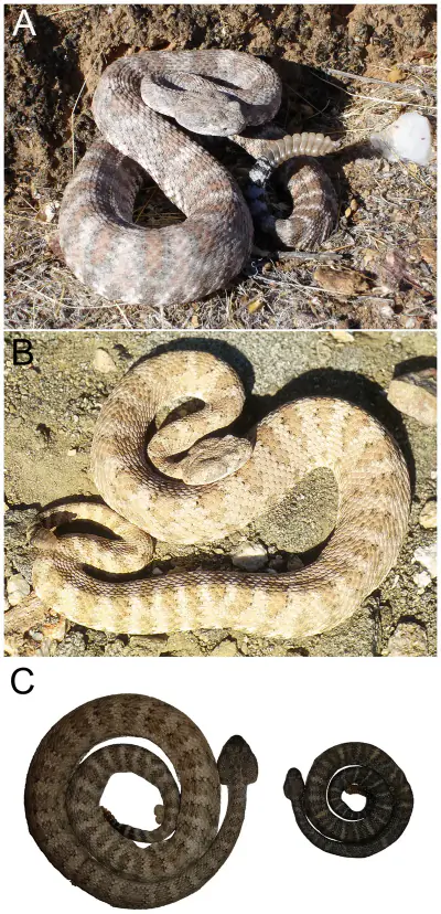 Southwestern Speckled Rattlesnake — A medium rattlesnake with speckled gray or pink coloration.
 -
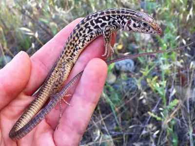 Western Whiptail — A slender, fast-moving lizard with a very long tail and distinct pale stripes over a dark body.
Amphibians (4)
-
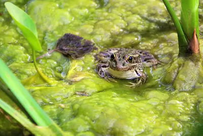 Relict Leopard Frog
 -
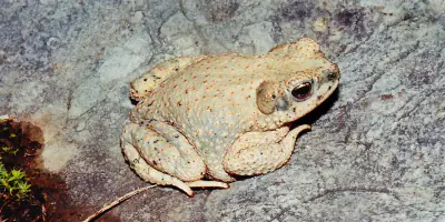 Red-spotted Toad
 -
 Woodhouse's Toad
 -
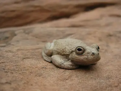 Canyon Tree Frog
Insects (1)
-
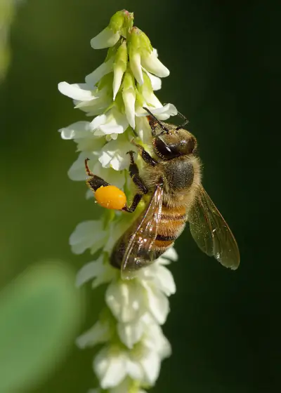 Western Honey Bee
Nature Bingo at Mt. Dellenbaugh Trailhead (E, 0mi), Mohave
Can you spot them all? Check off each species as you find it on your visit.
Wildlife Challenge
Botany Challenge
Mt. Dellenbaugh Trailhead (E, 0mi), Mohave Climate & Sun
Reference data: temperatures, precipitation, and daylight hours by month.
The annual average temperature here is 52.5°F, with 14.7 inches of precipitation.
Climate type: Semi-Arid
Annual avg temp: 52.5°F
Annual precipitation: 14.7 in
With an average annual temperature of 52.5°F and 14.7 inches of precipitation, Mt. Dellenbaugh Trailhead has mild, dry conditions. Summer highs average around 74°F, while winter lows drop to 35°F.
Best months to visit: May, Jun, Jul, Aug, Sep, Oct.
| Month | Avg Temp | Precip |
|---|---|---|
| Jan | 35°F | 1.3 in |
| Feb | 37°F | 1.4 in |
| Mar | 41°F | 1.4 in |
| Apr | 47°F | 0.7 in |
| May | 57°F | 0.5 in |
| Jun | 68°F | 0.3 in |
| Jul | 74°F | 2.5 in |
| Aug | 72°F | 2.1 in |
| Sep | 66°F | 1.3 in |
| Oct | 55°F | 1.3 in |
| Nov | 43°F | 0.7 in |
| Dec | 35°F | 1.2 in |
Daylight & Sun Times
Daylight ranges from 9.7 hours in winter to 14.6 hours in summer — a difference of 4.9 hours.
Summer: 4:16 AM – 6:52 PM
Winter: 6:37 AM – 4:20 PM
Mt. Dellenbaugh Trailhead (E, 0mi), Mohave Trip Planning & Access
Here's the practical side of visiting Mt. Dellenbaugh Trailhead.
Mt. Dellenbaugh Trailhead is 90 miles from Las Vegas — here's what to budget for the trip.
Visitor Friendliness
This location rates likely_allowed for dogs, excellent for families, and highly_suitable for elderly visitors.
- Dogs: likely_allowed — No restrictions found
- Families: excellent
- Elderly: highly_suitable
- Strollers: excellent (100/100)
- Beginners: Good starting point (Moderate difficulty (+5))
- Accessibility: Generally accessible to most visitors (90/100)
Places Near Mt. Dellenbaugh Trailhead (E, 0mi), Mohave
The area around Mt. Dellenbaugh Trailhead has plenty more to offer.
If you're exploring this part of Arizona, these nearby spots complement a visit to Mt. Dellenbaugh Trailhead.
Nearby Trails
- Mount Dellenbaugh Summit Trail, Mohave 2.27 mi
- Whitmore Trail, Mohave 17.62 mi
Nearby Attractions
Stargazing & Night Sky at Mt. Dellenbaugh Trailhead (E, 0mi), Mohave
After a day outdoors, the evening sky here is worth a look.
On clear nights, the Bortle class 3 skies above Mt. Dellenbaugh Trailhead reveal constellations and bright planets.
Constellations
From Mt. Dellenbaugh Trailhead, you can trace Ursa Minor, Cassiopeia, Cepheus across the sky on clear nights.
-
 Ursa Minor — Home to Polaris, the North Star, Ursa Minor forms a small dipper shape that circles the northern sky year-round.
 -
 Cassiopeia — Easily recognized by its bright W-shaped pattern, Cassiopeia stands out in northern skies.
 -
 Cepheus — Cepheus appears as a faint house-shaped pattern near Polaris in the northern sky.
Meteor Showers
Time your visit around December 13-14 for the Geminids, the strongest meteor shower visible from this latitude.
-
 Geminids — peaks December 13-14 (excellent)
One of the most reliable and active showers of the year; best viewed after 10 PM when Gemini rises higher in the sky.
-
 Quadrantids — peaks January 3-4 (excellent)
This brief but intense shower peaks before dawn; early morning hours offer the best chance to see multiple meteors.
-
 Perseids — peaks August 11-13 (excellent)
A summer favorite with warm nighttime viewing; look northeast after 10 PM.
-
 Eta Aquariids — peaks May 5-6 (good)
Best seen before dawn in the southeastern sky as Aquarius rises.
-
 Delta Aquariids — peaks July 28-29 (fair)
Best viewed after midnight when Aquarius is higher in the southern sky.
Planets
Planets visible to the naked eye from this location:
-
 Venus — The brightest planet, often called the Morning or Evening Star
 -
 Jupiter — The largest planet, bright and steady in the night sky
 -
 Saturn — Famous for its rings, visible as a golden steady light
 -
 Mars — The Red Planet, recognizable by its reddish-orange hue
Equipment Guide
- Naked eye: Venus, Jupiter, Saturn, Mars, Mercury (with care)
- Binoculars: Jupiter moons, Uranus, Saturn rings (barely)
- Small telescope: Saturn rings, Jupiter bands, Mars surface features, Neptune
Viewing Tips
- Check planets rise/set times for your specific date
- Planets appear along the ecliptic (zodiac path)
- Planets don't twinkle like stars - steady light
- Venus and Jupiter are unmistakable - brightest objects after Moon
- Use a stargazing app to confirm planet positions
- Best viewing: when planet is highest in sky (transit)
Best Viewing Months
- Evening: Oct, Nov, Dec, Jan, Feb
- Morning: Jul, Aug, Sep
Seasonal Highlights at Mt. Dellenbaugh Trailhead (E, 0mi), Mohave
The time of year you visit changes what you'll see and do.
Timing your visit to Mt. Dellenbaugh Trailhead around seasonal highlights can make a major difference in what you experience.
Spring Wildflowers
Peak bloom: April - May
Check local park websites for bloom reports
Fall Foliage
Peak color: September 15 – October 10
Best trees for color: Aspen, Cottonwood, Scrub Oak
At 6187ft elevation, expect peak 1-2 weeks earlier
Bird Migration
Spring peak: April - May
Fall peak: September - October
Best spots: Wetlands, coastlines, mountain ridges
Indigenous Land at Mt. Dellenbaugh Trailhead (E, 0mi), Mohave
Before planning your trip, it's worth recognizing the Indigenous peoples connected to this land.
Before this became a recreation area, this land belonged to Nuwuvi (Southern Paiute).
Territories
Data from Native Land Digital
Mt. Dellenbaugh Trailhead (E, 0mi), Mohave Geology & Natural History
Beyond the trails and wildlife, Mt. Dellenbaugh Trailhead sits within a landscape shaped by millions of years of geological processes. Here's what researchers and surveys have documented about this area.
Bedrock Geology
- Rock Type
- Permian to Pennsylvanian sedimentary rocks
- Formation
- Hermit Formation; Supai Group; Schnebly Hill Formation; Naco Group
- Lithology
- Major:{sandstone,shale,limestone}
- Age
- Paleozoic
Fossils
- Fossil Occurrences
- 15
- Unique Species
- 13
- Oldest
- 497 million years ago
Mineral Deposits
- Deposit Sites
- 4
- Richness
- Low
- Minerals Found
- Copper, Gypsum-Anhydrite, Iron, Manganese, Sand and Gravel, Construction
Endangered Species
- Species at Risk
- 1478
- ESA Endangered
- 29
- ESA Threatened
- 16
- Conservation Score
- 100/100
Temperature Records
- Record High
- 103°F (2021-07-10)
- Record Low
- -35°F (1990-12-22)
Wildfire History
This area has a high wildfire risk. Check current fire conditions before visiting and follow all fire restrictions. Campfires may be banned during dry seasons.
- Recorded Fires
- 12
- Largest Fire
- Twin compl (4,112.8 acres)
- Most Recent
- 2024
- Fire Risk
- High
Caves & Karst Features
- Feature Types
- Evaporite rocks at or near the land surface in a dry climate
- Karst Score
- 20
Watershed
- Watershed
- Surprise Canyon
- Water Quality (Good)
- 0%
- Impaired
- 0%
Mt. Dellenbaugh Trailhead (E, 0mi), Mohave Safety & Conditions
The weather data above tells you what's typical — these links tell you what's happening right now.
Before visiting Mt. Dellenbaugh Trailhead, verify current conditions through these authoritative sources.
Coordinates: 36.138126, -113.521496