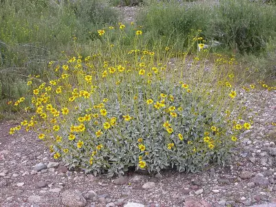
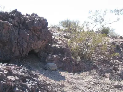
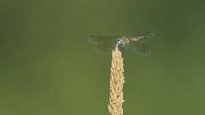
Mt. Wilson Access - Missouri Spr, Mohave
Day Use Areas in Arizona
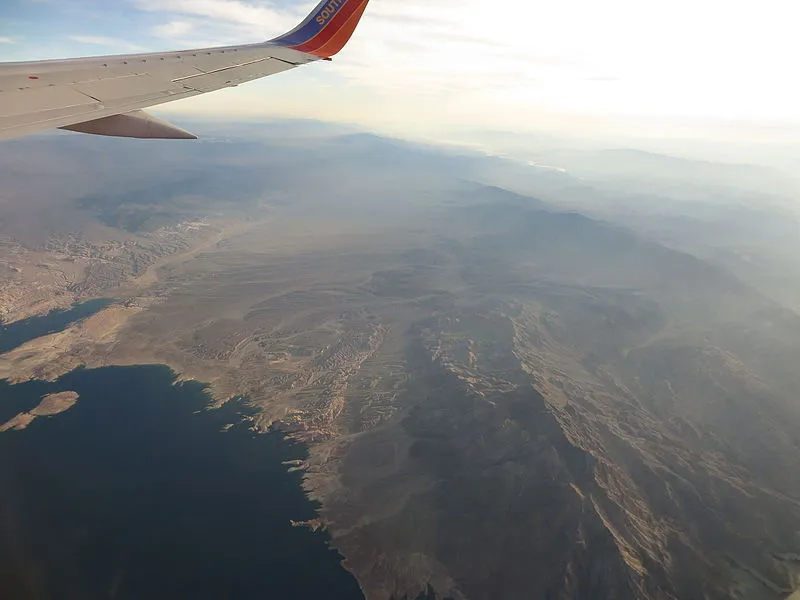
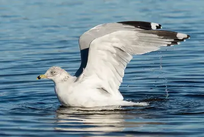
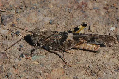
Photo: Ken Lund from Reno, Nevada, USA / CC BY-SA 2.0
Near Willow Beach, AZ in Arizona
What to Pack for Mt. Wilson Access - Missouri Spr, Mohave
A well-packed bag handles most of what this area can throw at you.
Between the Desert terrain and bear activity, your pack for Mt. Wilson Access - Missouri Spr needs a few specific items.
Essential
-
Water (minimum 2L) — Water sources marked on maps may be seasonal or dry; carrying enough to complete your route prevents a dangerous shortfall.
-
Navigation (map/GPS/compass) — Getting lost is the leading cause of backcountry search-and-rescue calls; reliable navigation prevents the situation entirely.
-
Sun protection (sunglasses, sunscreen) — Prolonged sun exposure causes headaches, fatigue, and heat exhaustion that can cut a trip short or create a medical emergency.
-
First aid kit — Remote locations mean longer response times for help; a first aid kit bridges the gap between injury and professional care.
-
Extra food — High-energy snacks weigh little but provide crucial fuel if you need to bushwhack out or wait for conditions to improve.
-
Headlamp with extra batteries — Hands-free light is essential for navigating uneven terrain, setting up camp, or signaling for help at night.
-
Fire starter — Waterproof matches or a ferro rod weigh almost nothing and can be the difference between a cold night and a survivable one.
-
Emergency shelter (space blanket) — Wind and rain strip heat faster than most people realize; a compact emergency shelter blocks both.
-
Knife or multi-tool — A multi-tool handles problems you can't predict: jammed zippers, tangled line, first-aid tape cutting, or gear fixes on the trail.
-
Extra clothing layer — A lightweight fleece or puffy stuffs small but provides critical insulation if temperatures drop unexpectedly.
Wildlife Gear
-
Bear canister — Many backcountry areas require approved bear canisters; an improperly stored food bag can result in fines and lost supplies.
-
Bear spray — A 30-foot spray cone gives you a critical buffer zone during a charge, without requiring precise aim under extreme stress.
-
Bear bell — Bears typically avoid humans when given advance warning; the steady jingle of a bear bell lets them move away before you arrive.
-
Hiking buddy (avoid solo) — A companion can help with first aid, signaling, and decision-making if a wildlife encounter turns serious.
-
Noise maker — Group noise is especially important in dense brush or near berry patches where bears may be feeding and less alert.
-
Gaiters — Thick gaiters deflect fangs before they reach skin, buying critical time in areas with rattlesnakes or copperheads.
-
First-aid snakebite kit — Knowing how to immobilize a limb, mark swelling progression, and avoid harmful folk remedies can improve outcomes.
Climate Gear
-
Extra water (1L/hr) — Heat exhaustion progresses to heat stroke rapidly once fluid reserves drop; consistent intake keeps your cooling system functional.
-
Electrolytes — Drinking large amounts of plain water without electrolytes can actually dilute blood sodium to dangerous levels during intense exertion.
-
Cooling towel — Evaporative cooling towels stay cold for hours when wet and can lower perceived temperature by several degrees.
-
Layering system (wide temp swings) — A base layer, insulating mid-layer, and wind shell cover the full range of temperatures you might encounter in a single day.
Terrain Gear
-
Wide-brim hat — At high elevation where UV is 10-12% stronger per 1,000 feet of gain, a hat provides constant passive protection.
-
Sunscreen SPF50+ — Sunburn isn't just discomfort — severe burns cause fluid loss, fatigue, and impaired thermoregulation that compound in remote settings.
-
Extra water (desert) — In arid heat, your body loses 1-2 liters per hour during exertion; running out of water in the desert is life-threatening.
Seasonal Gear
- Spring: Camera, Wildflower field guide
- Fall: Camera, Binoculars (foliage viewing)
Activities & Best Time to Visit Mt. Wilson Access - Missouri Spr, Mohave
The Desert terrain here lends itself to a range of outdoor activities throughout the year.
Oct, Nov, Dec, Jan, Feb, Mar, Apr is the prime window for visiting Mt. Wilson Access - Missouri Spr, when conditions favor backpacking and the weather cooperates.
With a photography score of 45/100, Mt. Wilson Access - Missouri Spr offers Decent dark sky (Bortle 5) and 3 excellent meteor showers worth capturing.
Activities
-
backpacking — Backpacking combines endurance, planning, and remote wilderness camping.
-
photography — Golden hour and dramatic weather can transform ordinary scenes into striking images.
-
picnicking — Picnicking turns a scenic overlook or shady grove into a memorable gathering spot.
-
walking — Walking lets you slow down and notice details — wildflowers, birdsong, shifting light through trees.
-
wildlife_viewing — Early mornings and dusk offer the best chances to quietly spot native wildlife.
Best months: Oct, Nov, Dec, Jan, Feb, Mar, Apr
Terrain: Desert — Cacti, shrubs, and drought-tolerant plants dominate arid landscapes.
Wildlife Safety at Mt. Wilson Access - Missouri Spr, Mohave
A few species in this area warrant awareness — here's what to keep in mind.
Mt. Wilson Access - Missouri Spr carries a danger score of 35/10, driven primarily by bears.
- Bears present
- Mountain lions
- Venomous snakes
- Decent dark sky (Bortle 5)
- 3 excellent meteor showers
- Fall foliage
- Spring wildflowers
Bears
Black Bear inhabit the forests around Mt. Wilson Access - Missouri Spr, foraging for berries, insects, and nuts.
Color varies widely from jet black to cinnamon brown, and occasionally blond, sometimes with a pale chest patch.
Store all food and scented items in bear-resistant containers and keep a clean campsite.
- Store food properly - use bear boxes or hang food bags
- Keep a clean camp - no food scraps
- Make noise while hiking
- Never approach cubs - mother is nearby
- Back away slowly if you encounter a bear
Venomous Snakes
Watch your step — are present in the Desert habitat around Mt. Wilson Access - Missouri Spr.
- Watch where you step and place hands
- Stay on trails
- Wear boots and long pants in snake country
- Do not reach under rocks or logs
- If bitten: stay calm, immobilize limb, seek medical help immediately
- Do NOT: cut wound, suck venom, apply tourniquet, ice, or alcohol
Nature & Wildlife at Mt. Wilson Access - Missouri Spr, Mohave
The Desert terrain here supports a rich ecosystem worth noticing as you explore.
Biodiversity at Mt. Wilson Access - Missouri Spr is shaped by the Desert terrain and Arid climate, producing distinct plant and animal communities.
Trees (1)
-
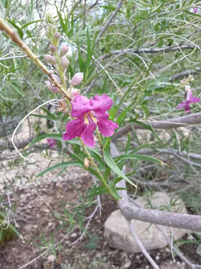 desert willow — It thrives in desert washes and arid soils.
Wildflowers (1)
-
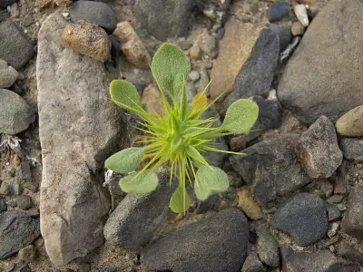 Devil's Spineflower — Leaves are narrow and linear.
Shrubs (6)
-
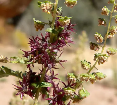
 Creosote Bush — An evergreen desert shrub with small resinous leaves divided into paired leaflets.
 -
 Burrobush — A desert shrub with narrow gray-green leaves and small white to pink flowers.
 -
 Brittlebush — A rounded desert shrub with silvery fuzzy leaves and bright yellow daisy-like flowers.
Other Plants (5)
-
California Barrel Cactus
-
Mojave Yucca
-
Beavertail Pricklypear
-
Cottontop Cactus
-
Johnson's Beehive Cactus
Mammals (3)
-
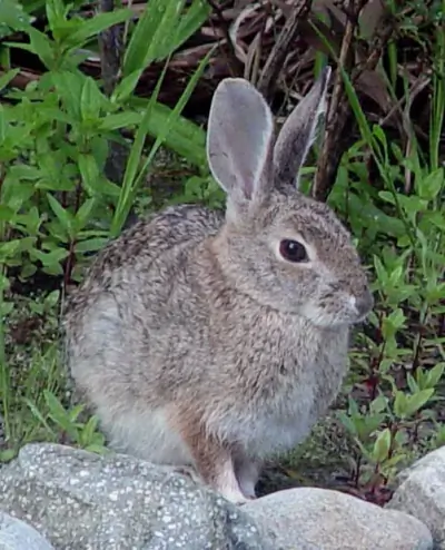 Desert Cottontail — Lean body suited to arid habitats.
 -
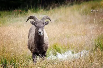 Bighorn Sheep — Rams carry massive curled horns.
 -
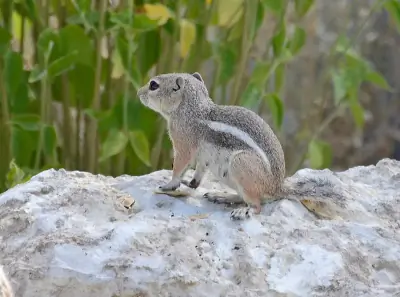 White-tailed Antelope Squirrel — White underside and underside of tail.
Birds (30)
-
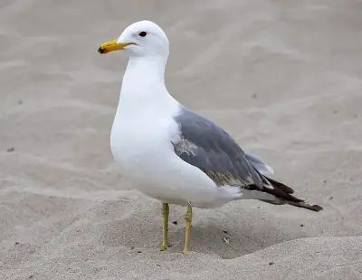
 Ring-billed Gull — Black ring on yellow bill
 -
 Common Goldeneye — Female brown-headed with gray body
 -
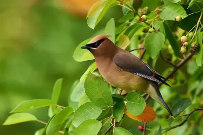 Cedar Waxwing — Yellow tail tip
 -
 Redhead — Gray body and black chest
 -
 California Gull — Yellow bill with red spot
Reptiles (7)
-
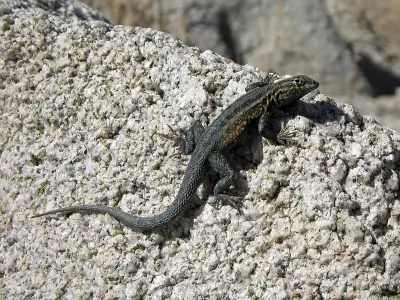 Common Side-blotched Lizard — Distinct dark blotch behind the front legs on each side.
 -
 Pond Slider — Some individuals have a red patch behind the eye.
 -
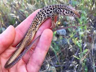 Western Whiptail — Usually brown to black with six to eight light longitudinal stripes.
 -
 Mojave Desert Tortoise — Front limbs are heavily scaled for digging.
 -
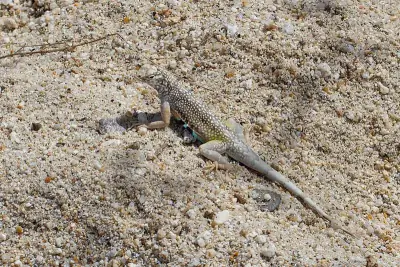 Zebra-tailed Lizard — Body is pale gray or tan with subtle patterning.
Insects (8)
-
 Blue Dasher
 -
 Mexican Amberwing
 -
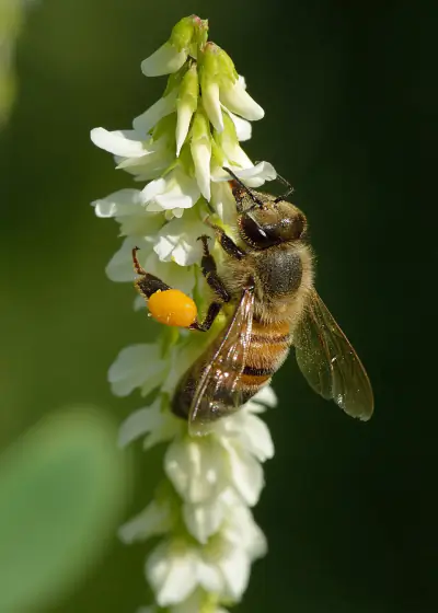 Western Honey Bee
 -
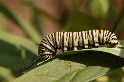 Monarch
 -
 Pallid-winged Grasshopper
Nature Bingo at Mt. Wilson Access - Missouri Spr, Mohave
Can you spot them all? Check off each species as you find it on your visit.
Wildlife Challenge
Botany Challenge
Mt. Wilson Access - Missouri Spr, Mohave Climate & Sun
Use this climate breakdown to plan around the weather.
Temperature and precipitation data for Mt. Wilson Access - Missouri Spr help narrow down the ideal visit window.
Climate type: Arid
Annual avg temp: 69.4°F
Annual precipitation: 6.1 in
With an average annual temperature of 69.4°F and 6.1 inches of precipitation, Mt. Wilson Access - Missouri Spr has warm, arid conditions. Summer highs average around 92°F, while winter lows drop to 49°F.
Best months to visit: Feb, Mar, Apr, Oct, Nov. Consider avoiding: Jul, Aug.
| Month | Avg Temp | Precip |
|---|---|---|
| Jan | 49°F | 0.8 in |
| Feb | 53°F | 1.1 in |
| Mar | 60°F | 0.6 in |
| Apr | 67°F | 0.3 in |
| May | 76°F | 0.1 in |
| Jun | 87°F | 0.1 in |
| Jul | 92°F | 0.5 in |
| Aug | 91°F | 0.5 in |
| Sep | 83°F | 0.3 in |
| Oct | 71°F | 0.6 in |
| Nov | 57°F | 0.4 in |
| Dec | 48°F | 0.8 in |
Daylight & Sun Times
Daylight ranges from 9.7 hours in winter to 14.6 hours in summer — a difference of 4.9 hours.
Summer: 4:20 AM – 6:55 PM
Winter: 6:41 AM – 4:25 PM
Mt. Wilson Access - Missouri Spr, Mohave Trip Planning & Access
With the lay of the land covered, here are the trip planning details.
At 36 miles from Las Vegas, Mt. Wilson Access - Missouri Spr is a day trip for most visitors.
Visitor Friendliness
Visitor friendliness: families (excellent), dogs (likely_allowed), elderly (highly_suitable).
- Dogs: likely_allowed — No restrictions found
- Families: excellent
- Elderly: highly_suitable
- Strollers: excellent (100/100)
- Beginners: Perfect for beginners (Easy difficulty - perfect for beginners (+20))
- Accessibility: Generally accessible to most visitors (100/100)
Places Near Mt. Wilson Access - Missouri Spr, Mohave
Nearby trails, campgrounds, and attractions expand what you can do on this trip.
Don't limit your trip to just Mt. Wilson Access - Missouri Spr — the surrounding area has 19 more places to discover.
Nearby Trails
Nearby Campgrounds
Nearby Attractions
Stargazing & Night Sky at Mt. Wilson Access - Missouri Spr, Mohave
Don't pack up when the sun goes down — the night sky here has plenty to offer.
Night falls differently here — the Bortle 5 rating means Suburban sky visibility for stars, planets, and meteor showers.
Constellations
Look for Ursa Minor, Cassiopeia, Cepheus — all visible from this location depending on the season.
-
 Ursa Minor — This compact constellation contains Polaris at the end of its handle, a reliable guide to true north.
 -
 Cassiopeia — This constellation represents a mythological queen and lies opposite the Big Dipper across Polaris.
 -
 Cepheus — Named for a mythological king, this constellation sits beside Cassiopeia and is circumpolar in northern latitudes.
Meteor Showers
For meteor viewing, the Geminids (December 13-14) offers the best show at this location.
-
 Geminids — peaks December 13-14 (excellent)
Cold December air often means clear skies—look overhead after midnight for bright, slow-moving meteors.
-
 Quadrantids — peaks January 3-4 (excellent)
Bundle up—January nights are frigid, but dark skies can produce bright fireballs.
-
 Perseids — peaks August 11-13 (excellent)
Peak activity typically builds after midnight when Perseus climbs higher.
-
 Eta Aquariids — peaks May 5-6 (good)
Southern U.S. observers often get better rates due to the radiant's position.
-
 Delta Aquariids — peaks July 28-29 (fair)
This steady shower rewards patient observers in dark, moonless conditions.
Planets
Planets visible to the naked eye from this location:
-
 Venus — The brightest planet, often called the Morning or Evening Star
 -
 Jupiter — The largest planet, bright and steady in the night sky
 -
 Saturn — Famous for its rings, visible as a golden steady light
 -
 Mars — The Red Planet, recognizable by its reddish-orange hue
Equipment Guide
- Naked eye: Venus, Jupiter, Saturn, Mars, Mercury (with care)
- Binoculars: Jupiter moons, Uranus, Saturn rings (barely)
- Small telescope: Saturn rings, Jupiter bands, Mars surface features, Neptune
Viewing Tips
- Check planets rise/set times for your specific date
- Planets appear along the ecliptic (zodiac path)
- Planets don't twinkle like stars - steady light
- Venus and Jupiter are unmistakable - brightest objects after Moon
- Use a stargazing app to confirm planet positions
- Best viewing: when planet is highest in sky (transit)
Best Viewing Months
- Evening: Oct, Nov, Dec, Jan, Feb
- Morning: Jul, Aug, Sep
Seasonal Highlights at Mt. Wilson Access - Missouri Spr, Mohave
Different seasons reveal different sides of Mt. Wilson Access - Missouri Spr.
Nature at Mt. Wilson Access - Missouri Spr follows a seasonal calendar — here's when to come for what you want to see.
Spring Wildflowers
Peak bloom: March - April
Check local park websites for bloom reports
Fall Foliage
Peak color: September 15 – October 10
Best trees for color: Aspen, Cottonwood, Scrub Oak
At 2208ft elevation, expect peak about 1 week earlier
Bird Migration
Spring peak: April - May
Fall peak: September - October
Best spots: Wetlands, coastlines, mountain ridges
Indigenous Land at Mt. Wilson Access - Missouri Spr, Mohave
This landscape holds cultural significance that extends far beyond recreation.
The cultural landscape of Mt. Wilson Access - Missouri Spr reflects the long presence of Hualapai on this land.
Territories
Languages
1 Indigenous languages are associated with the peoples of this area: Southern Paiute.
Data from Native Land Digital
Mt. Wilson Access - Missouri Spr, Mohave Geology & Natural History
Beyond the trails and wildlife, Mt. Wilson Access - Missouri Spr sits within a landscape shaped by millions of years of geological processes. Here's what researchers and surveys have documented about this area.
Bedrock Geology
- Rock Type
- Hualapai Limestone
- Formation
- Hualapai Limestone
- Age
- Miocene
Mineral Deposits
- Deposit Sites
- 43
- Richness
- High
- Minerals Found
- Gold, Gypsum-Anhydrite, Copper, Manganese, Uranium, Tungsten, Silver, Semiprecious Gemstone
Endangered Species
- Species at Risk
- 1478
- ESA Endangered
- 29
- ESA Threatened
- 16
- Conservation Score
- 100/100
Temperature Records
- Record High
- 120°F (2005-07-20)
- Record Low
- 18°F (1990-12-24)
Wildfire History
This area has a relatively low wildfire risk, but always follow posted fire regulations.
- Recorded Fires
- 6
- Largest Fire
- Fork (81,699 acres)
- Most Recent
- 2019
- Fire Risk
- Extreme
Watershed
- Watershed
- Wildhorse Spring-Detrital Wash
- Water Quality (Good)
- 0%
- Impaired
- 0%
Meteorite Landings
- Meteorites Found
- 5
- Largest
- Gold Basin (61 kg)
Mt. Wilson Access - Missouri Spr, Mohave Safety & Conditions
For up-to-the-minute safety information, use these official resources.
Don't rely on forecasts alone — check these live sources for the latest conditions near Mt. Wilson Access - Missouri Spr.
Coordinates: 35.981379, -114.538883