Cottonwood Point Wilderness, Mohave
Parks in Arizona
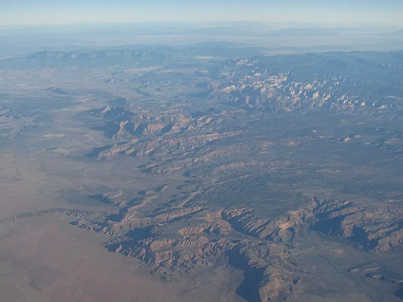
Photo: Ken Lund from Reno, Nevada, USA / CC BY-SA 2.0
Near Colorado City, AZ in Arizona
What to Pack for Cottonwood Point Wilderness, Mohave
The right gear makes all the difference — here's a packing list tailored to this area.
Your packing list for Cottonwood Point Wilderness should account for the Desert terrain and Semi-Arid.
Essential
-
Water (minimum 2L) — Water sources marked on maps may be seasonal or dry; carrying enough to complete your route prevents a dangerous shortfall.
-
Navigation (map/GPS/compass) — Getting lost is the leading cause of backcountry search-and-rescue calls; reliable navigation prevents the situation entirely.
-
Sun protection (sunglasses, sunscreen) — Prolonged sun exposure causes headaches, fatigue, and heat exhaustion that can cut a trip short or create a medical emergency.
-
First aid kit — Remote locations mean longer response times for help; a first aid kit bridges the gap between injury and professional care.
-
Extra food — High-energy snacks weigh little but provide crucial fuel if you need to bushwhack out or wait for conditions to improve.
-
Headlamp with extra batteries — Hands-free light is essential for navigating uneven terrain, setting up camp, or signaling for help at night.
-
Fire starter — Waterproof matches or a ferro rod weigh almost nothing and can be the difference between a cold night and a survivable one.
-
Emergency shelter (space blanket) — Wind and rain strip heat faster than most people realize; a compact emergency shelter blocks both.
-
Knife or multi-tool — A multi-tool handles problems you can't predict: jammed zippers, tangled line, first-aid tape cutting, or gear fixes on the trail.
-
Extra clothing layer — A lightweight fleece or puffy stuffs small but provides critical insulation if temperatures drop unexpectedly.
Wildlife Gear
-
Bear canister — Many backcountry areas require approved bear canisters; an improperly stored food bag can result in fines and lost supplies.
-
Bear spray — A 30-foot spray cone gives you a critical buffer zone during a charge, without requiring precise aim under extreme stress.
-
Bear bell — Bears typically avoid humans when given advance warning; the steady jingle of a bear bell lets them move away before you arrive.
-
Hiking buddy (avoid solo) — A companion can help with first aid, signaling, and decision-making if a wildlife encounter turns serious.
-
Noise maker — Group noise is especially important in dense brush or near berry patches where bears may be feeding and less alert.
-
Gaiters — Thick gaiters deflect fangs before they reach skin, buying critical time in areas with rattlesnakes or copperheads.
-
First-aid snakebite kit — Knowing how to immobilize a limb, mark swelling progression, and avoid harmful folk remedies can improve outcomes.
Climate Gear
-
Layering system (wide temp swings) — A base layer, insulating mid-layer, and wind shell cover the full range of temperatures you might encounter in a single day.
Terrain Gear
-
Wide-brim hat — At high elevation where UV is 10-12% stronger per 1,000 feet of gain, a hat provides constant passive protection.
-
Sunscreen SPF50+ — Sunburn isn't just discomfort — severe burns cause fluid loss, fatigue, and impaired thermoregulation that compound in remote settings.
-
Extra water (desert) — In arid heat, your body loses 1-2 liters per hour during exertion; running out of water in the desert is life-threatening.
-
SPF50 lip balm — High elevation, snow glare, and desert sun amplify UV exposure on exposed facial skin, especially lips.
Seasonal Gear
- Spring: Camera, Wildflower field guide
- Fall: Camera, Binoculars (foliage viewing)
- Winter: Microspikes/traction devices
Activities & Best Time to Visit Cottonwood Point Wilderness, Mohave
The Desert terrain here lends itself to a range of outdoor activities throughout the year.
Visitors come to Cottonwood Point Wilderness primarily for atv, though the Desert terrain opens up other options too.
With a photography score of 65/100, Cottonwood Point Wilderness offers Exceptional dark sky (Bortle 1-2) and 3 excellent meteor showers worth capturing.
Activities
-
atv — ATV riding covers varied terrain from sand to forest paths.
-
backpacking — Backpacking combines endurance, planning, and remote wilderness camping.
-
hiking — Hiking ranges from gentle nature walks to challenging summit climbs.
-
mountain_biking — Mountain biking combines speed, balance, and changing landscapes.
-
off_roading — Off-roading explores remote landscapes beyond paved roads.
-
photography — Golden hour and dramatic weather can transform ordinary scenes into striking images.
-
picnicking — Picnicking turns a scenic overlook or shady grove into a memorable gathering spot.
-
rock_climbing — Rock climbing ranges from beginner routes to advanced multi-pitch climbs.
-
rv_camping — RV camping blends outdoor living with modern amenities.
-
surfing — Surfing blends balance, timing, and ocean awareness.
-
walking — Walking lets you slow down and notice details — wildflowers, birdsong, shifting light through trees.
-
wildlife_viewing — Early mornings and dusk offer the best chances to quietly spot native wildlife.
Best months: May, Jun, Jul, Aug, Sep
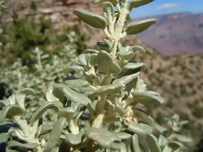
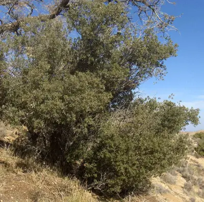
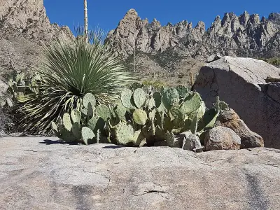
Terrain: Desert — Cacti, shrubs, and drought-tolerant plants dominate arid landscapes.
Wildlife Safety at Cottonwood Point Wilderness, Mohave
Most wildlife encounters are positive, but a few potential hazards are worth knowing about.
The danger rating here is 45/10 — Bears present and Mountain lions.
- Bears present
- Mountain lions
- Venomous snakes
- Remote (136mi from city)
- Exceptional dark sky (Bortle 1-2)
- 3 excellent meteor showers
- Fall foliage
- Spring wildflowers
Bears
Black Bear inhabit the forests around Cottonwood Point Wilderness, foraging for berries, insects, and nuts.
Color varies widely from jet black to cinnamon brown, and occasionally blond, sometimes with a pale chest patch.
If you encounter one, speak calmly, make yourself appear larger, and back away slowly without running.
- Store food properly - use bear boxes or hang food bags
- Keep a clean camp - no food scraps
- Make noise while hiking
- Never approach cubs - mother is nearby
- Back away slowly if you encounter a bear
Venomous Snakes
Watch your step — are present in the Desert habitat around Cottonwood Point Wilderness.
- Watch where you step and place hands
- Stay on trails
- Wear boots and long pants in snake country
- Do not reach under rocks or logs
- If bitten: stay calm, immobilize limb, seek medical help immediately
- Do NOT: cut wound, suck venom, apply tourniquet, ice, or alcohol
Nature & Wildlife at Cottonwood Point Wilderness, Mohave
The Desert terrain here supports a rich ecosystem worth noticing as you explore.
The forests and meadows around Cottonwood Point Wilderness support a diverse community of wildlife, from Mule Deer and Rock Squirrel to Brewer's Blackbird and Ruddy Duck.
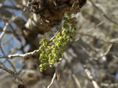
Trees (3)
-
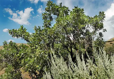 Gambel Oak — This species is common in foothills and lower mountain slopes of the southwestern United States.
 -
bigtooth maple — Paired winged seeds develop after spring flowering.
-
 Frémont Cottonwood — The crown spreads widely in open areas.
Wildflowers (1)
-
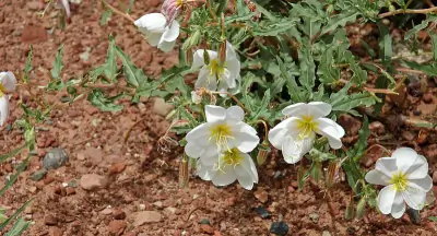 Pale Evening Primrose — Low spreading stems with gray-green leaves.
Shrubs (3)
-
 Roundleaf buffaloberry — Red berries appear in late summer.
 -
 Sonoran scrub oak — The plant forms thickets in arid landscapes.
 -
 Engelmann's Pricklypear — It grows in desert scrub habitats.
Other Plants (5)
-
Golden Pricklypear
-
Sacred Datura
-
Palmer's penstemon
-
mat rock spiraea
-
black maidenhair fern
Mammals (4)
-
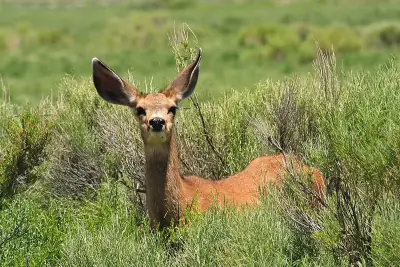 Mule Deer — Coat ranges from tawny brown in summer to gray-brown in winter.
 -
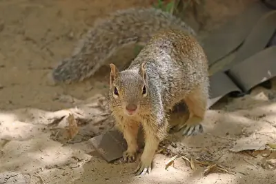 Rock Squirrel — Stouter and larger than many other ground squirrels.
 -
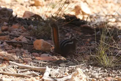 Uinta Chipmunk — White eye stripe contrasts with darker head lines.
 -
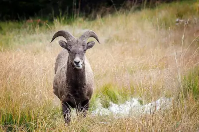 Bighorn Sheep — Rams carry massive curled horns.
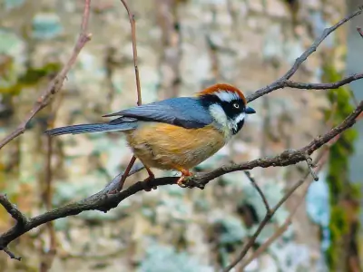
Birds (30)
-
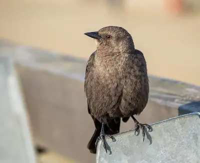 Brewer's Blackbird — Brown female with dark eye
 -
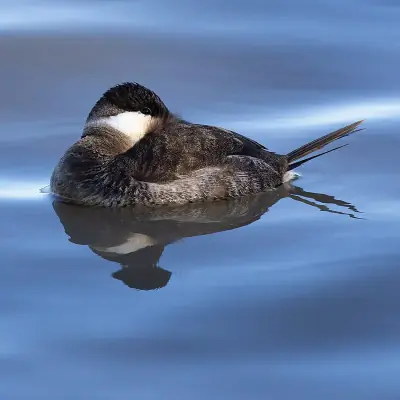 Ruddy Duck — Brown winter plumage
 -
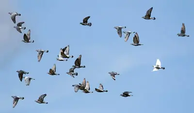 Rock Pigeon — White or mottled urban color morphs
 -
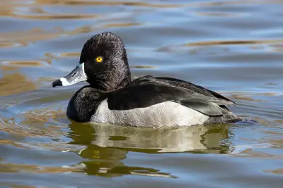 Ring-necked Duck — Female brown with white eye ring
 -
 Bushtit — Pale eye in female
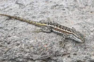
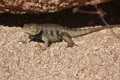
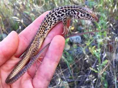
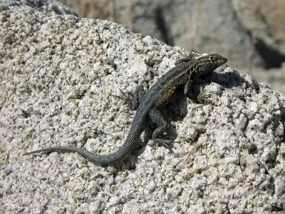
Reptiles (6)
-
 Plateau Fence Lizard — Males show blue belly patches.
 -
 Yellow-backed Spiny Lizard — Often patterned with darker blotches.
 -
 Western Whiptail — Usually brown to black with six to eight light longitudinal stripes.
 -
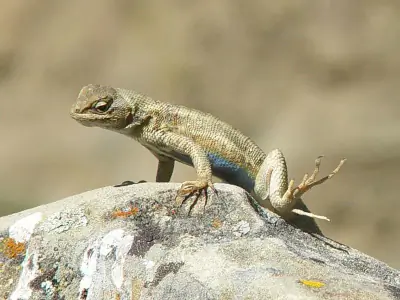 Common Sagebrush Lizard — Males may show blue patches on the belly.
 -
 Common Side-blotched Lizard — Distinct dark blotch behind the front legs on each side.
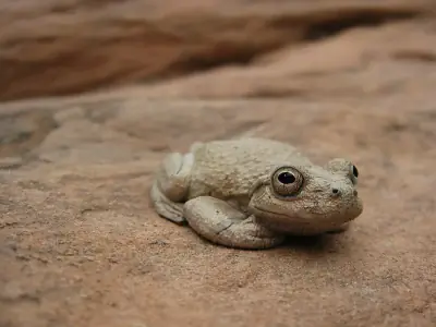
Amphibians (2)
-
 Canyon Tree Frog
 -
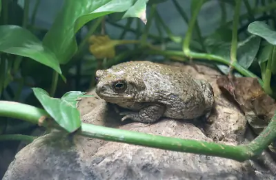 Arizona Toad
Insects (5)
-
Obscure Darkling Beetle
-
 Cotton-gall Tephritid
 -
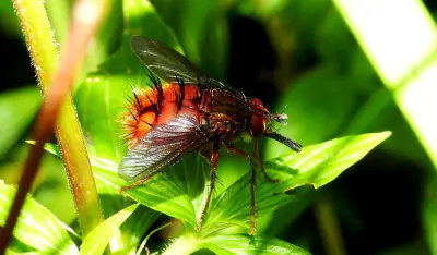 Spiny Tachina Fly
 -
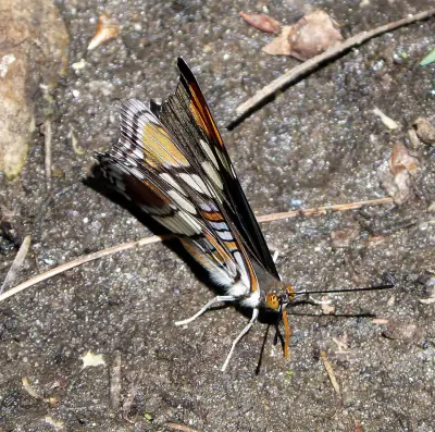 Arizona Sister
 -
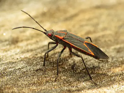 Eastern Boxelder Bug
Other Wildlife (1)
-
Desert Tarantula
Nature Bingo at Cottonwood Point Wilderness, Mohave
Can you spot them all? Check off each species as you find it on your visit.
Wildlife Challenge
Botany Challenge
Cottonwood Point Wilderness, Mohave Climate & Sun
Month-by-month climate and daylight information for Cottonwood Point Wilderness.
Cottonwood Point Wilderness experiences Semi-Arid conditions with average temperatures ranging from °F in to °F in .
Climate type: Semi-Arid
Annual avg temp: 52.7°F
Annual precipitation: 15.5 in
With an average annual temperature of 52.7°F and 15.5 inches of precipitation, Cottonwood Point Wilderness has mild, dry conditions. Summer highs average around 75°F, while winter lows drop to 34°F.
Best months to visit: May, Jun, Jul, Aug, Sep, Oct.
| Month | Avg Temp | Precip |
|---|---|---|
| Jan | 34°F | 1.7 in |
| Feb | 37°F | 2.1 in |
| Mar | 43°F | 1.8 in |
| Apr | 49°F | 1.2 in |
| May | 58°F | 0.7 in |
| Jun | 68°F | 0.4 in |
| Jul | 75°F | 1.2 in |
| Aug | 73°F | 1.6 in |
| Sep | 66°F | 1.2 in |
| Oct | 54°F | 1.2 in |
| Nov | 42°F | 1.0 in |
| Dec | 34°F | 1.4 in |
Daylight & Sun Times
Daylight ranges from 9.6 hours in winter to 14.7 hours in summer — a difference of 5.1 hours.
Summer: 4:11 AM – 6:52 PM
Winter: 6:37 AM – 4:16 PM
Cottonwood Point Wilderness, Mohave Trip Planning & Access
Ready to visit? Here's what to know about getting here and what it'll cost.
Getting to Cottonwood Point Wilderness means a 136-mile drive from Las Vegas, the closest major city.
Visitor Friendliness
Visitor friendliness: families (excellent), dogs (likely_allowed), elderly (highly_suitable).
- Dogs: likely_allowed — No restrictions found
- Families: excellent
- Elderly: highly_suitable
- Strollers: excellent (100/100)
- Beginners: Perfect for beginners (Moderate difficulty (+5), Near urban area - help nearby (+10), Good information available (+5))
- Accessibility: Generally accessible to most visitors (90/100)
Places Near Cottonwood Point Wilderness, Mohave
If you're in the area, these nearby destinations are worth considering too.
The area around Cottonwood Point Wilderness includes trails, campgrounds, and other destinations.
Nearby Trails
- Paved Sidewalk, AZ 12.69 mi
- Pipe Spring Nm Trail, AZ 12.69 mi
- Ridge Trail, AZ 12.69 mi
- Native Grass Exhibit Trail, Pipe Spring National Monument 12.78 mi
Stargazing & Night Sky at Cottonwood Point Wilderness, Mohave
If you're staying past sunset, the stargazing conditions here are worth planning around.
With Bortle class 1 skies, Cottonwood Point Wilderness offers Excellent dark-sky site conditions for observing the night sky.
Constellations
Look for Ursa Minor, Cassiopeia, Cepheus — all visible from this location depending on the season.
-
 Ursa Minor — This compact constellation contains Polaris at the end of its handle, a reliable guide to true north.
 -
 Cassiopeia — This constellation represents a mythological queen and lies opposite the Big Dipper across Polaris.
 -
 Cepheus — Named for a mythological king, this constellation sits beside Cassiopeia and is circumpolar in northern latitudes.
Meteor Showers
For meteor viewing, the Geminids (December 13-14) offers the best show at this location.
-
 Geminids — peaks December 13-14 (excellent)
Cold December air often means clear skies—look overhead after midnight for bright, slow-moving meteors.
-
 Quadrantids — peaks January 3-4 (excellent)
Bundle up—January nights are frigid, but dark skies can produce bright fireballs.
-
 Perseids — peaks August 11-13 (excellent)
Peak activity typically builds after midnight when Perseus climbs higher.
-
 Eta Aquariids — peaks May 5-6 (good)
Southern U.S. observers often get better rates due to the radiant's position.
-
 Delta Aquariids — peaks July 28-29 (fair)
This steady shower rewards patient observers in dark, moonless conditions.
Planets
Planets visible to the naked eye from this location:
-
 Venus — The brightest planet, often called the Morning or Evening Star
 -
 Jupiter — The largest planet, bright and steady in the night sky
 -
 Saturn — Famous for its rings, visible as a golden steady light
 -
 Mars — The Red Planet, recognizable by its reddish-orange hue
Equipment Guide
- Naked eye: Venus, Jupiter, Saturn, Mars, Mercury (with care)
- Binoculars: Jupiter moons, Uranus, Saturn rings (barely)
- Small telescope: Saturn rings, Jupiter bands, Mars surface features, Neptune
Viewing Tips
- Check planets rise/set times for your specific date
- Planets appear along the ecliptic (zodiac path)
- Planets don't twinkle like stars - steady light
- Venus and Jupiter are unmistakable - brightest objects after Moon
- Use a stargazing app to confirm planet positions
- Best viewing: when planet is highest in sky (transit)
Best Viewing Months
- Evening: Oct, Nov, Dec, Jan, Feb
- Morning: Jul, Aug, Sep
Seasonal Highlights at Cottonwood Point Wilderness, Mohave
Each season brings something different to this area.
What you'll see at Cottonwood Point Wilderness depends heavily on when you visit.
Spring Wildflowers
Peak bloom: April - May
Check local park websites for bloom reports
Fall Foliage
Peak color: September 15 – October 10
Best trees for color: Aspen, Cottonwood, Scrub Oak
At 5272ft elevation, expect peak 1-2 weeks earlier
Bird Migration
Spring peak: April - May
Fall peak: September - October
Best spots: Wetlands, coastlines, mountain ridges
Indigenous Land at Cottonwood Point Wilderness, Mohave
Long before trails were marked and campgrounds built, this land was home to Indigenous peoples.
This area is part of the ancestral territory of Nuwuvi (Southern Paiute), Pueblos.
Territories
Languages
1 Indigenous languages are associated with the peoples of this area: Southern Paiute.
Data from Native Land Digital
Cottonwood Point Wilderness, Mohave Geology & Natural History
Beyond the trails and wildlife, Cottonwood Point Wilderness sits within a landscape shaped by millions of years of geological processes. Here's what researchers and surveys have documented about this area.
Bedrock Geology
- Rock Type
- Moenkopi Formation
- Formation
- Moenkopi Formation
- Lithology
- Major:{sandstone,mudstone}, Minor:{gypsum}
- Age
- Triassic
Fossils
- Fossil Occurrences
- 8
- Unique Species
- 8
- Oldest
- 248.1 million years ago
Mineral Deposits
- Deposit Sites
- 15
- Richness
- Moderate
- Minerals Found
- Uranium, Copper, Sulfur-Pyrite, Silver, Lead, Gypsum-Anhydrite, Water, Free
Endangered Species
- Species at Risk
- 1478
- ESA Endangered
- 29
- ESA Threatened
- 16
- Conservation Score
- 100/100
Temperature Records
- Record High
- 113°F (2024-07-24)
- Record Low
- -13°F (1990-12-23)
Wildfire History
This area has a high wildfire risk. Check current fire conditions before visiting and follow all fire restrictions. Campfires may be banned during dry seasons.
- Recorded Fires
- 3
- Largest Fire
- MM 27 hwy 389 (64.2 acres)
- Most Recent
- 2020
- Fire Risk
- High
Caves & Karst Features
- Feature Types
- Evaporite rocks at or near the land surface in a dry climate
- Karst Score
- 20
Watershed
- Watershed
- Pipe Valley Wash
- Water Quality (Good)
- 0%
- Impaired
- 0%
Cottonwood Point Wilderness, Mohave Safety & Conditions
Conditions change fast outdoors — bookmark these official sources for your visit.
Real-time safety data for Cottonwood Point Wilderness — weather, fire, flood, and road conditions.
Coordinates: 36.981677, -112.915108