Tom's Canyon Trail, Kane
Parks in Arizona

Photo: When reusing, please credit me as author: Adam Kliczek, http://memoriesstay.com (CC-BY-SA-3.0) If you use my image on your website, please send me an email with webpage adress. Contact me at: adam.kliczekgmail.com pl en +/− pl en +/− / CC BY-SA 3.0 pl
Near North Rim, AZ in Arizona
What to Pack for Tom's Canyon Trail, Kane
Pack with the terrain and wildlife in mind, and you'll be ready for anything here.
Don't underpack for Tom's Canyon Trail. The conditions here — Desert, Semi-Arid, bears — call for thoughtful gear choices.
Essential
-
Water (minimum 2L) — Even cool-weather hiking demands steady hydration, as exertion and altitude increase water loss faster than most expect.
-
Navigation (map/GPS/compass) — Even well-marked trails have confusing junctions, especially in fog or snow; a GPS unit or downloaded map keeps you on route.
-
Sun protection (sunglasses, sunscreen) — Quality sunglasses prevent snow blindness and reduce eye strain during long days on exposed trails or ridgelines.
-
First aid kit — Adhesive bandages, antiseptic, and athletic tape handle the most common trail injuries and weigh under a pound.
-
Extra food — Blood sugar drops fast during sustained effort outdoors, and having a reserve keeps your body and mind sharp.
-
Headlamp with extra batteries — Batteries drain faster in cold weather; carrying spares ensures you won't be left in the dark when you need light most.
-
Fire starter — Starting a fire boosts morale and provides light, warmth, and a way to purify water in an emergency.
-
Emergency shelter (space blanket) — If an injury forces you to stop moving, a reflective blanket prevents the rapid heat loss that leads to hypothermia.
-
Knife or multi-tool — In a survival situation, a blade lets you process tinder, build shelter, and prepare food.
-
Extra clothing layer — Wet clothing accelerates cooling; a dry backup layer can prevent hypothermia when conditions turn.
Wildlife Gear
-
Bear canister — A hard-sided canister protects your food from raccoons, rodents, and other camp raiders too, not just bears.
-
Bear spray — Bear spray works on all bear species; keep it in a hip holster for instant access, not buried in your pack.
-
Bear bell — On windy trails or near streams where your voice might not carry, a bear bell provides constant, passive noise.
-
Hiking buddy (avoid solo) — Solo hikers are more vulnerable to predatory behavior from mountain lions, which typically avoid groups.
-
Noise maker — A loud whistle doubles as a rescue signal, serving both wildlife safety and emergency communication.
-
Gaiters — Beyond snakes, gaiters also protect against thorns, brush, and ticks in overgrown trail sections.
-
First-aid snakebite kit — A lightweight pressure bandage and marker for tracking swelling take up minimal space but provide critical aid.
Climate Gear
-
Layering system (wide temp swings) — Removing a layer before you sweat keeps your clothing dry, which is critical for warmth when temperatures drop again.
Terrain Gear
-
Wide-brim hat — Desert and alpine environments with little tree cover leave you fully exposed; a hat is your primary shade source.
-
Sunscreen SPF50+ — Apply 30 minutes before exposure and reapply every 2 hours; sweating and pack straps rub sunscreen off faster than expected.
-
Extra water (desert) — Even well-mapped springs can go dry after low-snowpack years; always carry surplus and check recent trip reports.
-
SPF50 lip balm — Reapply every 2 hours and after eating or drinking, as lip balm wears off faster than body sunscreen.
Seasonal Gear
- Spring: Camera, Wildflower field guide
- Fall: Camera, Binoculars (foliage viewing)
- Winter: Microspikes/traction devices
Activities & Best Time to Visit Tom's Canyon Trail, Kane
The Desert terrain here lends itself to a range of outdoor activities throughout the year.
Activity options at Tom's Canyon Trail range from casual () to more demanding ().
The scenery here earns a 65/100 photography rating — Exceptional dark sky (Bortle 1-2) and 3 excellent meteor showers.
Activities
-
hiking — With sturdy footwear and preparation, trails open up expansive views and quiet solitude.
-
horseback_riding — Guided rides are available in many parks and recreation areas.
-
mountain_biking — Helmets and trail awareness are essential for safety.
-
photography — Outdoor photography invites you to slow down and frame the beauty around you.
-
picnicking — Whether lakeside or in a meadow, it's a relaxed way to savor both the setting and the company.
-
sightseeing — It's an accessible way to appreciate the character of a place.
-
snowshoeing — It's accessible for beginners yet great exercise in cold weather.
-
surfing — Check local wave and tide conditions before heading out.
-
walking — Perfect for all ages, a casual walk can turn any outdoor space into a relaxing nature experience.
-
wildlife_viewing — Bring binoculars and patience — nature often rewards careful, respectful observers.
Best months: May, Jun, Jul, Aug, Sep
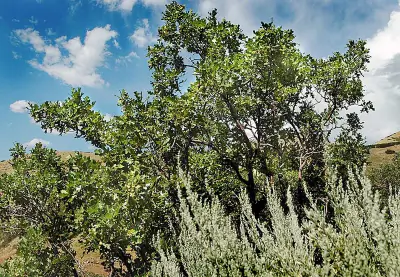
Terrain: Desert — Rocky outcrops, sand, and dry washes are common features.
Wildlife Safety at Tom's Canyon Trail, Kane
Before heading out, it helps to know which wildlife to be cautious around.
Responsible visitors at Tom's Canyon Trail should be aware of 2 wildlife-related considerations.
- Bears present
- Mountain lions
- Venomous snakes
- Remote (158mi from city)
- Exceptional dark sky (Bortle 1-2)
- 3 excellent meteor showers
- Fall foliage
- Spring wildflowers
Bears
Black Bear have been documented in this area. They're most active from .
Adults typically weigh 150 to 600 pounds, with males substantially larger than females.
If you encounter one, speak calmly, make yourself appear larger, and back away slowly without running.
- Store food properly - use bear boxes or hang food bags
- Keep a clean camp - no food scraps
- Make noise while hiking
- Never approach cubs - mother is nearby
- Back away slowly if you encounter a bear
Venomous Snakes
0 venomous snake species are found in this area: .
- Watch where you step and place hands
- Stay on trails
- Wear boots and long pants in snake country
- Do not reach under rocks or logs
- If bitten: stay calm, immobilize limb, seek medical help immediately
- Do NOT: cut wound, suck venom, apply tourniquet, ice, or alcohol
Nature & Wildlife at Tom's Canyon Trail, Kane
The Desert terrain here supports a rich ecosystem worth noticing as you explore.
From towering Gambel Oak and bigtooth maple to delicate Pale Evening Primrose, the vegetation here creates habitat for 4 mammal species and 30 birds.
Trees (3)
-
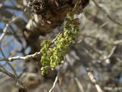
 Gambel Oak — It often grows in dense thickets, spreading by underground sprouts to form large colonies.
 -
bigtooth maple — Autumn color ranges from yellow to deep crimson in mountain canyons.
-
 Frémont Cottonwood — The bark is light gray and furrowed on mature trunks.
Wildflowers (1)
-
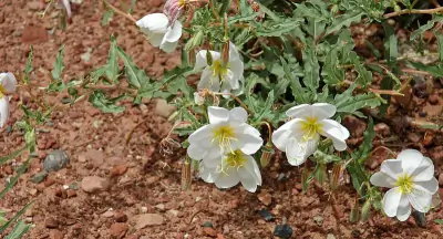 Pale Evening Primrose — Blooms fading to pink with age.
Shrubs (3)
-
 Roundleaf buffaloberry — Red berries appear in late summer.
 -
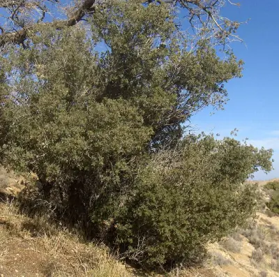 Sonoran scrub oak — Leaves are dark green and spiny along the margins.
 -
 Engelmann's Pricklypear — Spines are long and yellowish.
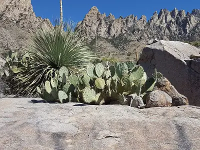
Other Plants (5)
-
Golden Pricklypear
-
Sacred Datura
-
Palmer's penstemon
-
mat rock spiraea
-
black maidenhair fern
Mammals (4)
-
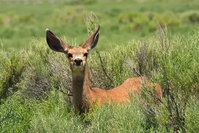 Mule Deer — Bucks carry branching antlers that fork rather than form a single main beam.
 -
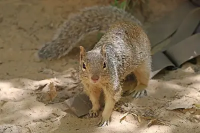 Rock Squirrel — Often stands upright on rocks to scan for predators.
 -
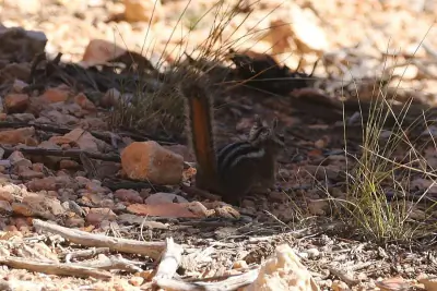 Uinta Chipmunk — Short bushy tail.
 -
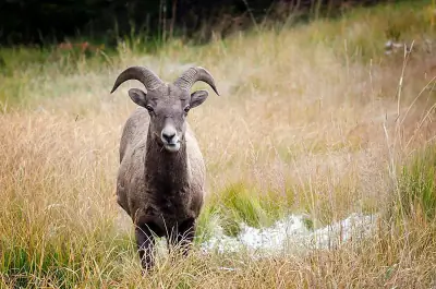 Bighorn Sheep — Sure-footed build adapted to steep cliffs.
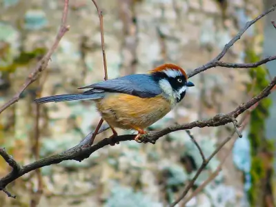
Birds (30)
-
 Brewer's Blackbird — Iridescent purple-green sheen
 -
 Ruddy Duck — Stiff upright tail
 -
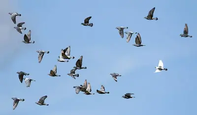 Rock Pigeon — Dark charcoal form with iridescent neck
 -
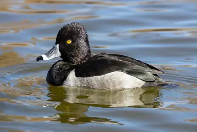 Ring-necked Duck — Subtle chestnut neck ring rarely visible
 -
 Bushtit — Soft fluffy plumage
Reptiles (6)
-
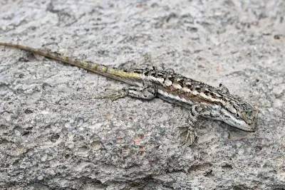 Plateau Fence Lizard — Usually 5–7 inches long including tail.
 -
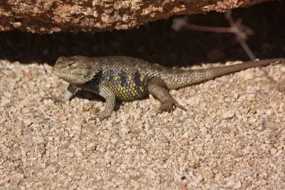 Yellow-backed Spiny Lizard — Typically 6–8 inches long.
 -
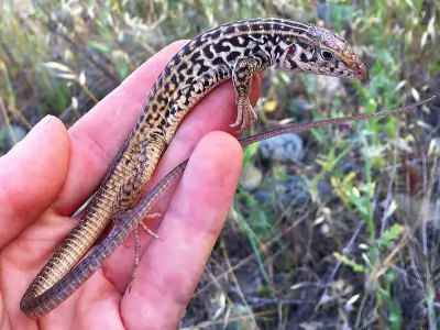 Western Whiptail — Typically 8–12 inches long including the tail.
 -
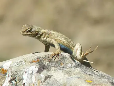 Common Sagebrush Lizard — Usually under 5 inches long excluding tail.
 -
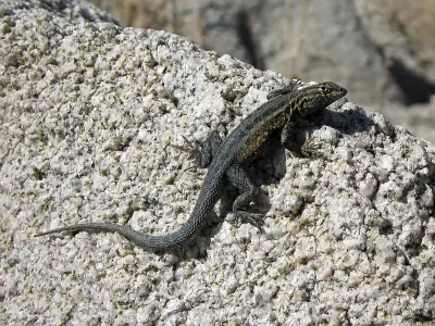 Common Side-blotched Lizard — Typically 4–6 inches long including the tail.
Amphibians (2)
-
 Canyon Tree Frog
 -
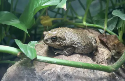 Arizona Toad
Insects (5)
-
Obscure Darkling Beetle
-
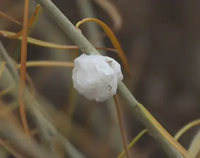 Cotton-gall Tephritid
 -
 Spiny Tachina Fly
 -
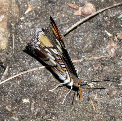 Arizona Sister
 -
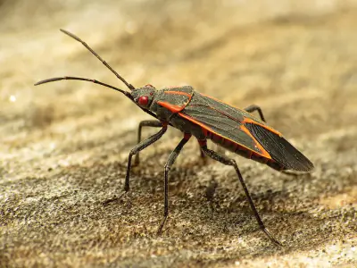 Eastern Boxelder Bug
Other Wildlife (1)
-
Desert Tarantula
Nature Bingo at Tom's Canyon Trail, Kane
Can you spot them all? Check off each species as you find it on your visit.
Wildlife Challenge
Botany Challenge
Tom's Canyon Trail, Kane Climate & Sun
The numbers behind the best (and worst) times to visit Tom's Canyon Trail.
Reference climate data for planning your visit to Tom's Canyon Trail — temperatures, precipitation, and daylight hours.
Climate type: Semi-Arid
Annual avg temp: 54.1°F
Annual precipitation: 15.3 in
With an average annual temperature of 54.1°F and 15.3 inches of precipitation, Tom's Canyon Trail has mild, dry conditions. Summer highs average around 76°F, while winter lows drop to 35°F.
Best months to visit: Apr, May, Jun, Aug, Sep, Oct.
| Month | Avg Temp | Precip |
|---|---|---|
| Jan | 35°F | 1.7 in |
| Feb | 39°F | 1.9 in |
| Mar | 45°F | 1.6 in |
| Apr | 51°F | 0.9 in |
| May | 60°F | 0.7 in |
| Jun | 70°F | 0.3 in |
| Jul | 76°F | 1.2 in |
| Aug | 74°F | 1.5 in |
| Sep | 67°F | 1.4 in |
| Oct | 55°F | 1.5 in |
| Nov | 43°F | 1.1 in |
| Dec | 35°F | 1.5 in |
Daylight & Sun Times
Daylight ranges from 9.6 hours in winter to 14.7 hours in summer — a difference of 5.1 hours.
Summer: 4:09 AM – 6:50 PM
Winter: 6:35 AM – 4:14 PM
Tom's Canyon Trail, Kane Trip Planning & Access
Time to plan the details — access, cost, and travel information for your visit.
Here are the logistics for getting to Tom's Canyon Trail and what to expect on arrival.
Visitor Friendliness
Accessibility: dog-friendly (likely_allowed), family-friendly (excellent), elderly-friendly (highly_suitable).
- Dogs: likely_allowed — No restrictions found
- Families: excellent
- Elderly: highly_suitable
- Strollers: excellent (100/100)
- Beginners: Perfect for beginners (Moderate difficulty (+5), Good information available (+5))
- Accessibility: Generally accessible to most visitors (90/100)
Places Near Tom's Canyon Trail, Kane
Looking for more? Here's what else is close by.
Close-by alternatives and additions to your Tom's Canyon Trail visit include these 8 destinations.
Nearby Trails
- Native Grass Exhibit Trail, Pipe Spring National Monument 17.74 mi
- Native Grass Exhibit Trail, Pipe Spring National Monument 17.74 mi
- Paved Sidewalk, AZ 17.81 mi
- Ridge Trail, AZ 17.81 mi
- Pipe Spring Nm Trail, AZ 17.81 mi
Stargazing & Night Sky at Tom's Canyon Trail, Kane
Clear nights in this area reveal more stars than most people expect.
The darkness at Tom's Canyon Trail is rated Bortle class 1, offering Excellent dark-sky site conditions year-round.
Constellations
Key constellations visible from this latitude include Ursa Minor, Cassiopeia, Cepheus.
-
 Ursa Minor — Visible throughout the year in much of the United States, Ursa Minor rotates steadily around the North Celestial Pole.
 -
 Cassiopeia — Visible year-round in northern states, Cassiopeia is especially prominent in autumn evenings.
 -
 Cepheus — Though its stars are modest in brightness, Cepheus is visible year-round from most of the U.S.
Meteor Showers
The Geminids peaks around December 13-14 and is the best meteor shower visible from here.
-
 Geminids — peaks December 13-14 (excellent)
Find a dark location away from city lights and give your eyes 20–30 minutes to adjust for peak rates.
-
 Quadrantids — peaks January 3-4 (excellent)
Look toward the northern sky after midnight for the highest activity.
-
 Perseids — peaks August 11-13 (excellent)
Expect fast, bright meteors and occasional fireballs under dark skies.
-
 Eta Aquariids — peaks May 5-6 (good)
Plan for early morning viewing; activity increases in the hours just before sunrise.
-
 Delta Aquariids — peaks July 28-29 (fair)
Southern states often see stronger activity due to radiant placement.
Planets
Planets visible to the naked eye from this location:
-
 Venus — The brightest planet, often called the Morning or Evening Star
 -
 Jupiter — The largest planet, bright and steady in the night sky
 -
 Saturn — Famous for its rings, visible as a golden steady light
 -
 Mars — The Red Planet, recognizable by its reddish-orange hue
Equipment Guide
- Naked eye: Venus, Jupiter, Saturn, Mars, Mercury (with care)
- Binoculars: Jupiter moons, Uranus, Saturn rings (barely)
- Small telescope: Saturn rings, Jupiter bands, Mars surface features, Neptune
Viewing Tips
- Check planets rise/set times for your specific date
- Planets appear along the ecliptic (zodiac path)
- Planets don't twinkle like stars - steady light
- Venus and Jupiter are unmistakable - brightest objects after Moon
- Use a stargazing app to confirm planet positions
- Best viewing: when planet is highest in sky (transit)
Best Viewing Months
- Evening: Oct, Nov, Dec, Jan, Feb
- Morning: Jul, Aug, Sep
Seasonal Highlights at Tom's Canyon Trail, Kane
What you'll encounter here shifts with the calendar — here's a seasonal overview.
The experience at Tom's Canyon Trail shifts with the seasons. Here's a month-by-month overview.
Spring Wildflowers
Peak bloom: April - May
Check local park websites for bloom reports
Fall Foliage
Peak color: September 15 – October 10
Best trees for color: Aspen, Cottonwood, Scrub Oak
At 5026ft elevation, expect peak 1-2 weeks earlier
Bird Migration
Spring peak: April - May
Fall peak: September - October
Best spots: Wetlands, coastlines, mountain ridges
Indigenous Land at Tom's Canyon Trail, Kane
The history of this land reaches back long before it became a recreation destination.
Before trails were marked here, Nuwuvi (Southern Paiute), Pueblos knew this land intimately.
Territories
Data from Native Land Digital
Tom's Canyon Trail, Kane Geology & Natural History
Beyond the trails and wildlife, Tom's Canyon Trail sits within a landscape shaped by millions of years of geological processes. Here's what researchers and surveys have documented about this area.
Bedrock Geology
- Rock Type
- Navajo Sandstone, Kayenta and Moenave Formations
- Formation
- Navajo Sandstone; Kayenta Formation; Moenave Formation
- Lithology
- Major:{arenite,sandstone mudstone}, Incidental:{limestone}
- Age
- Jurassic
Fossils
- Fossil Occurrences
- 90
- Unique Species
- 50
- Oldest
- 227.3 million years ago
Mineral Deposits
- Deposit Sites
- 39
- Richness
- High
- Minerals Found
- Sand and Gravel, Construction, Stone, Crushed/Broken, Gypsum-Anhydrite, Gemstone, Copper, Silica
Endangered Species
- Species at Risk
- 2596
- ESA Endangered
- 44
- ESA Threatened
- 29
- Conservation Score
- 100/100
Temperature Records
- Record High
- 108°F (2021-07-10)
- Record Low
- -20°F (1937-01-22)
Wildfire History
This area has a high wildfire risk. Check current fire conditions before visiting and follow all fire restrictions. Campfires may be banned during dry seasons.
- Recorded Fires
- 18
- Largest Fire
- Deer Springs (11,765.7 acres)
- Most Recent
- 2024
- Fire Risk
- High
Watershed
- Watershed
- Dry Lake Canyon-Johnson Wash
- Water Quality (Good)
- 0%
- Impaired
- 100%
Reported Phenomena
- UFO Sightings
- 3 (NUFORC)
- Eeriness Score
- 6/100
Tom's Canyon Trail, Kane Safety & Conditions
Plans set? Check the latest conditions before you head out.
Before any visit to Tom's Canyon Trail, a quick check of these official sources can prevent surprises.
Coordinates: 37.051332, -112.519868